XPSWMM Conversion Export SWMM Pipe Network Data
Revision as of 11:10, 15 February 2024 by Chris Huxley (talk | contribs) (Created page with "=== Export 1D EPA SWMM Pipe Network Data from XPSWMM === Convert 1D XPSWMM hydraulics features into a EPA SWMM 5 INP file format for TUFLOW: <ol> <li> In XPSWMM, select 'Hydra...")
Export 1D EPA SWMM Pipe Network Data from XPSWMM
Convert 1D XPSWMM hydraulics features into a EPA SWMM 5 INP file format for TUFLOW:
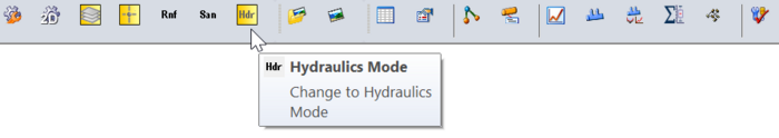
- In XPSWMM, select 'Hydraulics Mode' from the toolbar.
- From the XPSWMM top dropmenu, select File > Import/Export Data > Export to EPASWMM5. The exported INP file will be saved under the same name and in the same folder location as the .xp project file.
- When prompted to save changes, select 'Yes'.
- In Windows File Explorer, navigate to the folder containing the .xp project file and rename the exported INP file by adding 'HDR' to the file name. For example, 1D2D_Urban_001.inp > 1D2D_Urban_HDR_001.inp.
- Copy the renamed INP file into the TUFLOW\model\swmm folder. From this folder, drag and drop the .inp file into QGIS. This will open the 'GeoPackage - Create from SWMM inp ' tool from the QGIS Processing Toolbox.
- SWMM Input File (inp): Pre-populated
- CRS for GeoPackage: Select and appropriate Coordinate Reference System (CRS) for the model.
- GeoPackage output filename: Prepopulated to save the output GeoPackage file under the same name and in the same folder location as the SWMM input file.
- Click 'Run'. Once the tool is finished, click 'Close'.
- A dialog will appear. Select 'Add Layers' to open all vectors within the newly created SWMM GeoPackage file. By default, all items in the available list should have been selected.
- In the QGIS Layers panel, move the SWMM GeoPackage file to the top of the list. This will ensure the data within this database file is displayed above all other layers in the project.
- Inspect the attributes associated with the various objects in the GeoPackage to familiarize yourself with the data.

The process above has created a Nodes--Junctions layer, containing all the model nodes. In the Convert XPSWMM Model to Recommended TUFLOW Structure section, an improperly formatted layer of the same nodes was generated from XPSWMM. To prevent future errors, this layer should be removed from the QGIS workspace and deleted from its GeoPackage.
- In the QGIS Layers panel, open the tbc group (i.e. 1D2D_Urban_001.tbc). Right click the 2d_bc points layer and select 'Remove Layer...'.
- From the top dropdown menu options, select View > Panels. Tick on 'Browser Panel'.
- In the QGIS Browser panel, navigate to the TUFLOW\model\gis folder and open the GeoPackage layer tree.
- Note: Within the QGIS Browser panel, there is a dropdown directory, 'Project Home'. This directory is a shortcut to the location where the QGIS workspace is saved.
- Right click 2d_bc points layer (i.e.1D2D_Urban_001_2d_bc_P) and select Manage > Delete Layer.