Uploads by Par
This special page shows all uploaded files.
| Date | Name | Thumbnail | Size | Description | Versions |
|---|---|---|---|---|---|
| 08:58, 28 May 2025 | Msg 0627 csv xf supported.JPG (file) | 25 KB | 1 | ||
| 08:56, 28 May 2025 | Msg 0627 csv xf unsupported.JPG (file) | 31 KB | 1 | ||
| 23:53, 20 April 2018 | Osgeo4w matplotlib.PNG (file) | 9 KB | 1 | ||
| 23:51, 20 April 2018 | Osgeo4w qgis-ltr.PNG (file) | 18 KB | 1 | ||
| 23:43, 20 April 2018 | Osgeo4w install.png (file) |  |
5 KB | 1 | |
| 23:40, 20 April 2018 | Osgeo4w advanced.png (file) |  |
4 KB | 1 | |
| 12:50, 25 October 2016 | Check Files Str Grp 001.png (file) | 10 KB | 1 | ||
| 18:16, 22 March 2016 | TuPlot TabularData 02.PNG (file) | 67 KB | QGIS TuPlot Tabular Data 02 | 1 | |
| 18:07, 22 March 2016 | TuPlot TabularData 01A.PNG (file) | 138 KB | QGIS TuPlot Tabular Data 01 | 1 | |
| 13:15, 22 March 2016 | TuPlot LongProfile 03.PNG (file) | 10 KB | QGIS TuPlot Long Profile 03 Animation pop up | 1 | |
| 13:04, 22 March 2016 | TuPlot LongProfile 02A.PNG (file) | 83 KB | QGIS TuPlot Long Profile 02 - Adverse gradients | 1 | |
| 12:56, 22 March 2016 | TuPlot LongProfile 01B.PNG (file) | 147 KB | QGIS TuPlot Long Profile 01 | 1 | |
| 09:26, 22 March 2016 | TuPlot Timeseries 03A.PNG (file) | 55 KB | QGIS TuPlot Timeseries 03 multiple results files | 1 | |
| 09:08, 22 March 2016 | TuPlot Timeseries 02A.PNG (file) | 76 KB | QGIS TuPlot Timeseries Plot 02 (dual axis) | 1 | |
| 15:16, 21 March 2016 | TuPlot Timeseries 01A.PNG (file) | 141 KB | QGIS TuPlot Plotting timeseries data 01 | 1 | |
| 15:00, 21 March 2016 | TuPlot Results Loaded.PNG (file) | 81 KB | QGIS TuPlot after results have been loaded. | 1 | |
| 12:25, 21 March 2016 | TuPlot Layout2 Markup.PNG (file) | 10 KB | QGIS TuPlot Dock Window Description 02 | 1 | |
| 12:24, 21 March 2016 | TuPlot Layout1 Markup.PNG (file) | 43 KB | QGIS TuPlot Dock Window Description 01 | 1 | |
| 12:15, 21 March 2016 | TuPlot Icon 01.JPG (file) | 9 KB | QGIS TuPlot Icon 01 | 1 | |
| 16:10, 15 March 2016 | Python Results 2016 LP Example 01.png (file) |  |
50 KB | Python TUFLOW results library long profile example 01 | 1 |
| 15:42, 15 March 2016 | Python Results 2016 QV Example 01.png (file) |  |
56 KB | Python TUFLOW results library flow and velocity example 01 | 1 |
| 15:32, 15 March 2016 | Python Results 2016 H Example 01.png (file) | 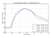 |
70 KB | Python TUFLOW results library water level example 01 | 1 |
| 15:17, 15 March 2016 | Python Results 2016 Q Example 01.png (file) |  |
41 KB | Python TUFLOW results library flow example 01 | 1 |
| 15:07, 14 March 2016 | TRFCF Polygon 001.jpg (file) | 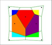 |
123 KB | TRFCF Polygon interpolation method 01 | 1 |
| 15:06, 14 March 2016 | TRFCF TIN 001.jpg (file) | 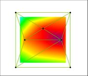 |
171 KB | TRFCF TIN interpolation method 01 | 1 |
| 15:04, 14 March 2016 | TRFCF IDW 001.jpg (file) | 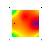 |
96 KB | TRFCF IDW interpolation 01 | 1 |
| 15:01, 14 March 2016 | TRFCF Legend.jpg (file) | 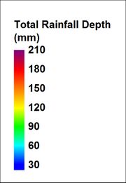 |
94 KB | TRFCF Total Depth Legend 01 | 1 |
| 10:44, 1 March 2016 | Trfcf model overview 01.jpg (file) | 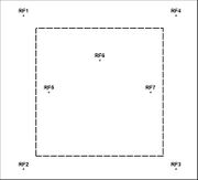 |
140 KB | TRFCF example control files 01 | 1 |
| 07:37, 12 February 2016 | WARNING 2074.jpg (file) |  |
115 KB | 2 | |
| 08:19, 3 February 2016 | Check Files 2d to 2d 01.jpg (file) |  |
126 KB | Check Files: 2d_to_2d 01 styled based on the primary node. | 1 |
| 13:41, 2 February 2016 | Check Files 1d to 2d 01.jpg (file) |  |
250 KB | Check Files: 1d_to_2D 01 - styled by 2D connection type. | 1 |
| 12:58, 2 February 2016 | Check Files 1d nwk pSlope 01.jpg (file) |  |
43 KB | Check Files: 1d_nwk_C 01 - styled by pSlope (% slope) | 1 |
| 12:52, 2 February 2016 | Check Files 1d inverts 01.jpg (file) |  |
45 KB | Check Files: inverts 01 - styled by invert elevation. | 1 |
| 12:48, 2 February 2016 | Check Files 1d hydroprop 01.jpg (file) |  |
51 KB | Check Files: 1d_hydroprop 01. Layer is styled by conveyance. | 1 |
| 12:40, 2 February 2016 | Check Files 1d bc 01.jpg (file) |  |
42 KB | Check Files: 1d_bc check 01 - styled by type attribute. | 1 |
| 12:25, 2 February 2016 | Check Files pit inlet 01.jpg (file) |  |
90 KB | Check Files: Pit Inlet 01 | 1 |
| 09:33, 2 February 2016 | Check Files vzsh zpt dz 01.jpg (file) |  |
74 KB | Check Files: Variable Z Shape check style by dz 01 | 1 |
| 09:14, 2 February 2016 | Check Files uvpt n 01.jpg (file) | 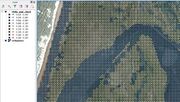 |
260 KB | Check Files: _uvpt styled by Manning's n | 1 |
| 11:05, 28 January 2016 | Check Files 2d zln zsh zpt 01.jpg (file) |  |
115 KB | Check Files: MapInfo symbology _zln_zpt and _zsh_zpt | 1 |
| 10:52, 25 January 2016 | Check Files input layer 01.JPG (file) | 88 KB | Check Files: _input_layers version 01. | 1 | |
| 09:18, 25 January 2016 | Check Files dem M 01.jpg (file) | 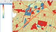 |
138 KB | Check files DEM_M version 01 | 1 |
| 08:41, 25 January 2016 | Check files bcc check.JPG (file) | 118 KB | Check Files: _bcc_check styled by boundary type | 1 | |
| 09:06, 18 December 2015 | Check Files dem z 01.jpg (file) | 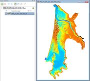 |
84 KB | Check Files DEM Z 01 | 1 |
| 08:54, 18 December 2015 | Check Files 2d zpt 02.jpg (file) | 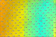 |
1.48 MB | Check Files 2D Zpt Elevation | 1 |
| 08:52, 18 December 2015 | Check Files 2d zpt 01.jpg (file) |  |
1,013 KB | Check Files 2D Zpt Type | 1 |
| 10:44, 15 December 2015 | Check Files 1d ta tables 03.jpg (file) | 25 KB | Check Files - 1d_ta_tables 03 | 1 | |
| 10:30, 15 December 2015 | Check Files 1d ta tables 02.jpg (file) | 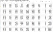 |
138 KB | Check Files 1d_ta_tables 02 | 1 |
| 10:29, 15 December 2015 | Check Files 1d ta tables 01.jpg (file) | 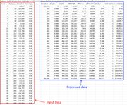 |
741 KB | Check Files 1d_ta_tables 01 | 1 |
| 14:31, 14 December 2015 | Check Files bc dbase example01.JPG (file) | 27 KB | Example boundary database including multipliers and add values. | 1 | |
| 14:23, 14 December 2015 | Check Files 2d bc tables.JPG (file) | 100 KB | Check Files - 2d BC tables HQ curve | 1 |