Tutorial M01 Time Series Plot Output QGIS: Difference between revisions
Jump to navigation
Jump to search
Content deleted Content added
| Line 19: | Line 19: | ||
<li>Digitise a line from left to right looking downstream across the floodplain and channel. |
<li>Digitise a line from left to right looking downstream across the floodplain and channel. |
||
<li>Populate the attribute table as follows: |
<li>Populate the attribute table as follows: |
||
:* Type = |
:* Type = Q_ |
||
:* Label = |
:* Label = Loc1_L |
||
<li>Toggle the editing off to save the edits.<br> |
<li>Toggle the editing off to save the edits.<br> |
||
<br> |
<br> |
||
[[File: |
[[File:Animation_M01_PO_01f.gif]]<br> |
||
<br> |
<br> |
||
</ol> |
</ol> |
||
| Line 40: | Line 40: | ||
<li>Populate the attribute table as follows: |
<li>Populate the attribute table as follows: |
||
:* Type = H_V_ |
:* Type = H_V_ |
||
:* Label = |
:* Label = Loc1_P |
||
<li>Toggle the editing off to save the edits.<br> |
<li>Toggle the editing off to save the edits.<br> |
||
<br> |
<br> |
||
[[File: |
[[File:Animation_M01_PO_02e.gif]]<br> |
||
<br><br> |
<br><br> |
||
</ol> |
</ol> |
||
Revision as of 13:15, 27 April 2023
Introduction
QGIS is used to create time series plot outputs. Two types are described:
- 2d_po line object - records average water level (_H) and flow (Q) across the line; and
- 2d_po point object - records water level (_H) and velocity (_V) in the cell where the point falls into.
Method
Create 2d_po line layer with the TUFLOW plugin:
- Click on the ‘Import Empty File’ symbol from the TUFLOW plugin toolbar.
- Select '2d_po' from the Empty Type list.
- In the Run ID box write 'M01_001'.
- Tick the 'Lines' Geometry Type and hit 'OK'.
- The 2d_po_M01_001_L appears in the Layers panel.
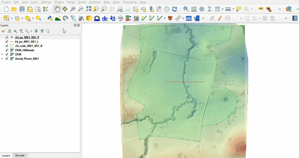
Digitise a plot output line from left to right looking downstream. The direction of the line is important, the opposite direction would produce negative values:
- Make the layer editable and select ‘Add Line Feature’.
- Digitise a line from left to right looking downstream across the floodplain and channel.
- Populate the attribute table as follows:
- Type = Q_
- Label = Loc1_L
- Toggle the editing off to save the edits.

Create 2d_po point layer with the TUFLOW plugin:
- Click on the ‘Import Empty File’ symbol from the TUFLOW plugin toolbar.
- Select 2d_po from the Empty Type list.
- In the Run ID box write 'M01_001'.
- Tick the 'Points' Geometry Type and hit 'OK'.
- The 2d_po_M01_001_P appears in the Layers panel.
Digitise a plot output point in the channel where the 2d_po line crosses the channel:
- Make the layer editable and select ‘Add Point Feature’.
- Digitise a point within the channel where the line crosses the channel.
- Populate the attribute table as follows:
- Type = H_V_
- Label = Loc1_P
- Toggle the editing off to save the edits.

Conclusion
- The 2d_po layers were created, containing a line recording flow and average water level across the line and point recording water level and velocity.
| Up |
|---|