MiTools Tips: Difference between revisions
Jump to navigation
Jump to search
Content deleted Content added
Chris Huxley (talk | contribs) Created page with "= Description = The MapInfo and TUFLOW Productivity Utilities (miTools) have been developed specifically to improve the efficiency of setting up and reviewing TUFLOW models, ..." |
Chris Huxley (talk | contribs) |
||
| (7 intermediate revisions by 3 users not shown) | |||
| Line 1: | Line 1: | ||
= Description = |
= Description = |
||
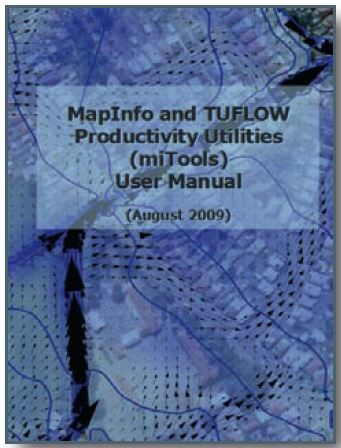
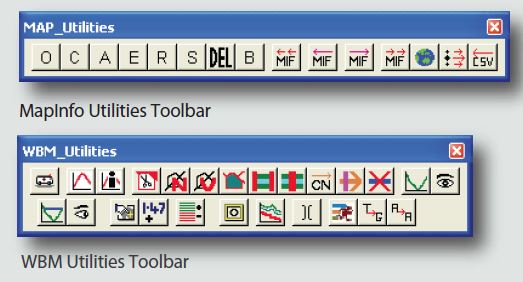
| ⚫ | MapInfo and TUFLOW Productivity Utilities (miTools) is a MapInfo add-on that is available for download from the <u>[https://www.tuflow.com/downloads/#gis_tools TUFLOW website]</u>. MiTools have been developed specifically to improve the efficiency of setting up and reviewing TUFLOW models, as well as improving the day to day ease of using MapInfo Professional (MI Pro). The suite of utilities enables ‘automation’ of many of the common repetitive tasks, saving valuable time and therefore money. The utilities also allow the efficient creation and visualisation of key TUFLOW model inputs/outputs within the MapInfo environment. Other tools provide data checking and quality assurance functionality, thus helping to minimise modeling errors. |
||
| ⚫ | |||
[[File: miTools_001.JPG]] |
[[File: miTools_001.JPG]] |
||
| Line 14: | Line 15: | ||
== Other Capabilities == |
== Other Capabilities == |
||
* A cross-section editor to view and edit CSV format cross-sections. The utility includes a data management tool that tracks changes to the cross-section properties, as well saving backup files following each subsequent change. |
* A cross-section editor to view and edit CSV format cross-sections. The utility includes a data management tool that tracks changes to the cross-section properties, as well saving backup files following each subsequent change. |
||
* A range of |
* A range of Flood Modeller-TUFLOW related utilities (especially for UK customers) including a utility to extract cross-sections from an Flood Modeller DAT format file into individual ESTRY format CSV files and a utility to name Flood Modeller 1d_nwk channels the same as the upstream node ID. |
||
== TUFLOW Capabilities == |
== TUFLOW Capabilities == |
||
| Line 32: | Line 33: | ||
* ‘Increment’ the selected TUFLOW layer: The utility assists to ensure TUFLOW MI layers are correctly renamed and setup for editing in an efficient manner. |
* ‘Increment’ the selected TUFLOW layer: The utility assists to ensure TUFLOW MI layers are correctly renamed and setup for editing in an efficient manner. |
||
* Label selected TUFLOW layer with associated elevation or invert data, to user specified formats with the click of a single button. The user can customise the number ofdecimal places displayed, the label styles (colour, options, size, font), as well as the visibility options for the labels (eg the zoom display range). |
* Label selected TUFLOW layer with associated elevation or invert data, to user specified formats with the click of a single button. The user can customise the number ofdecimal places displayed, the label styles (colour, options, size, font), as well as the visibility options for the labels (eg the zoom display range). |
||
* Filter TUFLOW layers: a utility to assist in dealing with large and complicated TUFLOW models. The utility will turn on or a specific layer types, as well as DEMs and images. The utility also has an option to group and sort TUFLOW layers in the current map window, based on the file type order |
* Filter TUFLOW layers: a utility to assist in dealing with large and complicated TUFLOW models. The utility will turn on or a specific layer types, as well as DEMs and images. The utility also has an option to group and sort TUFLOW layers in the current map window, based on the file type order specified in a customisable .ini file. |
||
* Quickly turn on the borders of thematically mapped grid cells. |
* Quickly turn on the borders of thematically mapped grid cells. |
||
Latest revision as of 11:08, 16 July 2025
Description
MapInfo and TUFLOW Productivity Utilities (miTools) is a MapInfo add-on that is available for download from the TUFLOW website. MiTools have been developed specifically to improve the efficiency of setting up and reviewing TUFLOW models, as well as improving the day to day ease of using MapInfo Professional (MI Pro). The suite of utilities enables ‘automation’ of many of the common repetitive tasks, saving valuable time and therefore money. The utilities also allow the efficient creation and visualisation of key TUFLOW model inputs/outputs within the MapInfo environment. Other tools provide data checking and quality assurance functionality, thus helping to minimise modeling errors.
General MapInfo Capabilities
- Efficiently manipulate MapInfo’s Layer Control without having to scroll through countless layers. Based on selected object(s), switch the layer on, make it editable, make it non-selectable, close it or open the table in a browser window. Filter the Layer Control to remove unused layers and/or close unused tables and/or delete selected objects without having to make then layer editable.
- Batch import MID/MIF files and automatically add them to Layer Control
- Import a MID/MIF file and automatically add it to the Layer Control as the top-layer and set it to editable. If it is a TUFLOW layer, apply the user defined default object styles
- Batch export MID/MIF files, as well as prompt for packing, saving edits, etc.
Other Capabilities
- A cross-section editor to view and edit CSV format cross-sections. The utility includes a data management tool that tracks changes to the cross-section properties, as well saving backup files following each subsequent change.
- A range of Flood Modeller-TUFLOW related utilities (especially for UK customers) including a utility to extract cross-sections from an Flood Modeller DAT format file into individual ESTRY format CSV files and a utility to name Flood Modeller 1d_nwk channels the same as the upstream node ID.
TUFLOW Capabilities
- MapInfo interfaces for common TUFLOW utilities TUFLOW_to_GIS and ASC_to_ASC.
- MapInfo interface to run TUFLOW, create and run TUFLOW batch files, and to test and package models.
- Automatically apply predefined MapInfo object styles to TUFLOW layers.
- Enhanced single and batch MIF import and export utilities.
- Automatically create and trim TUFLOW Water Level Lines(WLL), as well as cross-section (XS) lines.
- Extract multiple TUFLOW CSV format cross-sections from a Vertical Mapper DEM, and automatically assign roughness’s from a materials or Manning’s table.
- CSV Cross-section editor with inbuilt version and edit tracking.
- Automatically draw, attribute and snap TUFLOW CN Lines.
- Batch split a polyline, such as a river centreline, using a table of cross-sections. The utility is extremely useful for quickly setting up 1d networks where existing cross-section and river centreline/long-section data are available.
- Graph the TUFLOW MID/MIF time-series (TS) results data for selected TS objects within MapInfo. Summarise the maximum and minimum of the saved TS values for the active TS Graph window. Filter the graphs - i.e. to display only a sub-set of all the TS objects selected, such as the flows (Q) only.
- Plot TUFLOW CSV format cross-sections within MapInfo. Include TUFLOW water level results if required.
- Create long-section plots within MapInfo. Plot pipe obvert levels, minimum cover levels and highlight pits where the outlet level is higher than the lowest inlet(s), i.e. an error in the data.
- Region/polygon editing tools to speed up snapping, trimming and splitting region objects while also ensuring the resulting objects are truly snapped together.
- ‘Increment’ the selected TUFLOW layer: The utility assists to ensure TUFLOW MI layers are correctly renamed and setup for editing in an efficient manner.
- Label selected TUFLOW layer with associated elevation or invert data, to user specified formats with the click of a single button. The user can customise the number ofdecimal places displayed, the label styles (colour, options, size, font), as well as the visibility options for the labels (eg the zoom display range).
- Filter TUFLOW layers: a utility to assist in dealing with large and complicated TUFLOW models. The utility will turn on or a specific layer types, as well as DEMs and images. The utility also has an option to group and sort TUFLOW layers in the current map window, based on the file type order specified in a customisable .ini file.
- Quickly turn on the borders of thematically mapped grid cells.
| Up |
|---|

