TUFLOW SWMM Tutorial M01 Results QGIS: Difference between revisions
Jump to navigation
Jump to search
Content deleted Content added
Chris Huxley (talk | contribs) No edit summary |
|||
| (31 intermediate revisions by 3 users not shown) | |||
| Line 1: | Line 1: | ||
==SWMM.rpt Output== |
|||
The SWMM simulation report can be opened using a text editor to review the 1D SWMM model result summary and simulation health. |
|||
<ol> |
<ol> |
||
<li>In Windows File Explorer, navigate to the '''TUFLOW\results''' folder and open '''TS01_5m_001_swmm.rpt''' in Notepad++. |
|||
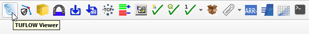
<li>Open TUFLOW Viewer in the QGIS TUFLOW Plugin. |
|||
<li>Review the result summary for information such as: |
|||
| ⚫ | |||
:*'''Continuity Error (%) .....''': The target value for this metric is less than +-1% |
|||
| ⚫ | |||
:* Various Node Result Summary Reports |
|||
| ⚫ | |||
:* Various Link / Conduit Result Summary Reports |
|||
| ⚫ | |||
| ⚫ | |||
| ⚫ | |||
{{Video|name=Animation_TS1_Results_01c.mp4|width=1236}}<br> |
|||
| ⚫ | |||
| ⚫ | |||
| ⚫ | |||
| ⚫ | |||
| ⚫ | |||
==QGIS Result Viewing== |
|||
Plot culvert time series flow results: |
|||
<ol> |
<ol> |
||
<li>Open TUFLOW Viewer |
<li>Open TUFLOW Viewer from the TUFLOW Plugin toolbar.<br> |
||
<li>Select File > Load Results - Time Series. Navigate to the '''TS01_5m_001_swmm_ts.gpkg''' in the '''TUFLOW_SWMM_Module_01\TUFLOW\results''' folder and open it. |
|||
<li>Two additional files appear in the Layers panel: |
|||
*'''TS01_5m_001_PLOT_L''' |
|||
*'''TS01_5m_001_PLOT_P''' |
|||
<li>Select the '''TS01_5m_001_PLOT_L''' file in the Layers panel and using the 'Select Features' tool highlight one of the pipe lines (to highlight multiple hold down shift). |
|||
<li>Select one of the Time Series datasets shown with the [[File:results_2.png | 15px]] icon and the 'Time Series' tab gets updated. <br> |
|||
<br> |
<br> |
||
[[File:tuflow_plugin_tuflow_viewer.png]]<br> |
|||
<font color="red">'''<< Add video >>'''</font> <br> |
|||
<br> |
<br> |
||
| ⚫ | |||
| ⚫ | |||
| ⚫ | |||
| ⚫ | |||
| ⚫ | |||
| ⚫ | |||
| ⚫ | |||
| ⚫ | |||
| ⚫ | |||
<br> |
|||
{{Video|name=Animation_TS1_Results_02d.mp4|width=1350}}<br> |
|||
<li>In the TUFLOW Viewer Panel, select (left click) '''TS01_5m_001''' to establish it as the active dataset. Click on a scalar dataset 'Depth' under the Result Type in the TUFLOW Viewer 'Map Outputs' list. Move the time slider to observe how the results vary at different times during the simulation.<br> |
|||
'''Note:''' The styling of the Map Outputs can be changed by right clicking on each result dataset and editing the 'Properties'. |
|||
<br><br> |
|||
{{Video|name=Animation_TS1_Results_03d.mp4|width=1350}}<br> |
|||
<li>In the QGIS Layers Panel, right click '''TS01_5m_001_swmm_ts_L''' and select 'Zoom to Layer(s)'. |
|||
<li>Use the 'Select Features' tool to highlight all items included in '''TS01_5m_001_swmm_ts_L'''. |
|||
<li>Click on the 'Flow' dataset under the Result Type in the TUFLOW Viewer 'Time Series' list. |
|||
<li>Tick on 'Show Current Time'. <br> |
|||
'''Note:''' The styling of the labels can be changed by right clicking on the layer and selecting 'Properties...'. |
|||
<br><br> |
|||
{{Video|name=Animation_TS1_Results_04d.mp4|width=1350}}<br> |
|||
</ol> |
</ol> |
||
Plot culvert longitudinal profiles:<br> |
|||
| ⚫ | |||
<li>The available long profile result types have a long profile icon [[File:Image XSLongProfile.png]] and display in the 'Cross Section / Long Profile' tab.<br> |
|||
<br> |
<br> |
||
<font color="red">'''<< Add video >>'''</font> <br> |
|||
{{Tips Navigation |
|||
|uplink=[[TUFLOW_SWMM_Tutorial_M01#Check_Files_and_Results_Output| Back to TUFLOW SWMM Tutorial 1]] |
|uplink=[[TUFLOW_SWMM_Tutorial_M01#Check_Files_and_Results_Output| Back to TUFLOW SWMM Tutorial 1]] |
||
}} |
}} |
||
| ⚫ | |||
Latest revision as of 11:30, 16 July 2025
SWMM.rpt Output
The SWMM simulation report can be opened using a text editor to review the 1D SWMM model result summary and simulation health.
- In Windows File Explorer, navigate to the TUFLOW\results folder and open TS01_5m_001_swmm.rpt in Notepad++.
- Review the result summary for information such as:
- Continuity Error (%) .....: The target value for this metric is less than +-1%
- Various Node Result Summary Reports
- Various Link / Conduit Result Summary Reports
QGIS Result Viewing
- Open TUFLOW Viewer from the TUFLOW Plugin toolbar.
- Open the simulation results. There are two options available:
- Open 1D and 2D results: Select File > Load Results. Navigate to the TUFLOW\runs folder and select TS01_5m_001.tcf.
- Open 1D (no 2D results): Select File > Load Results - Time Series. Navigate to the TUFLOW\results\plot folder and select TS01_5m_001_swmm_ts.gpkg.
- The video example below opens the 1D and 2D results, using the first of the above options. When asked 'Do you want to open result GIS layer?', select 'Yes'. Five new files will load to the QGIS Layers Panel:
- TS01_5m_001_swmm_ts_P: 1D SWMM Node and outlet water level results
- TS01_5m_001_swmm_ts_L: 1D SWMM conduit flow results
- TS01_5m_001_PLOT_P: 1D ESTRY and 2D plot output water level and velocity results (Note: There are no ESTRY results from this simulation)
- TS01_5m_001_PLOT_L: 1D ESTRY and 2D plot output flow results (Note: There are no ESTRY results from this simulation)
- TS01_5m_001: 2D TUFLOW results
- In the TUFLOW Viewer Panel, select (left click) TS01_5m_001 to establish it as the active dataset. Click on a scalar dataset 'Depth' under the Result Type in the TUFLOW Viewer 'Map Outputs' list. Move the time slider to observe how the results vary at different times during the simulation.
Note: The styling of the Map Outputs can be changed by right clicking on each result dataset and editing the 'Properties'.
- In the QGIS Layers Panel, right click TS01_5m_001_swmm_ts_L and select 'Zoom to Layer(s)'.
- Use the 'Select Features' tool to highlight all items included in TS01_5m_001_swmm_ts_L.
- Click on the 'Flow' dataset under the Result Type in the TUFLOW Viewer 'Time Series' list.
- Tick on 'Show Current Time'.
Note: The styling of the labels can be changed by right clicking on the layer and selecting 'Properties...'.

| Up |
|---|