QGIS OpenLayers: Difference between revisions
Jump to navigation
Jump to search
Content deleted Content added
Chris Huxley (talk | contribs) No edit summary |
Chris Huxley (talk | contribs) No edit summary |
||
| Line 1: | Line 1: | ||
Aerial imagery can be added using core XYZ Tile Server functionality (implemented in 2018): |
Aerial imagery can be added using core XYZ Tile Server functionality (implemented in 2018): |
||
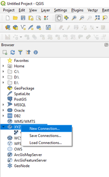
* Locate the Tile Server entry and right click it to add a new service. |
* Locate the Tile Server entry in the browser and right click it to add a new service. |
||
[[File:QGIS_Aerial_001.png |
[[File:QGIS_Aerial_001.png]] <br> |
||
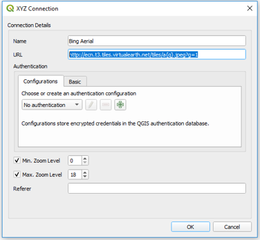
* Enter the URL of the service which you would like to use. Example URLs are listed at he bottom of this page. |
* Enter the URL of the service which you would like to use. Example URLs are listed at he bottom of this page. |
||
| ⚫ | |||
| ⚫ | |||
| ⚫ | |||
OpenStreetMap: |
OpenStreetMap: |
||
http://tile.openstreetmap.org/{z}/{x}/{y}.png |
http://tile.openstreetmap.org/{z}/{x}/{y}.png |
||
| Line 21: | Line 17: | ||
Google Road |
Google Road |
||
https://mt1.google.com/vt/lyrs=m&x={x}&y={y}&z={z} |
https://mt1.google.com/vt/lyrs=m&x={x}&y={y}&z={z} |
||
| ⚫ | |||
| ⚫ | |||
| ⚫ | |||
Revision as of 06:00, 26 February 2019
Aerial imagery can be added using core XYZ Tile Server functionality (implemented in 2018):
- Locate the Tile Server entry in the browser and right click it to add a new service.
- Enter the URL of the service which you would like to use. Example URLs are listed at he bottom of this page.
 OpenStreetMap:
 http://tile.openstreetmap.org/{z}/{x}/{y}.png
 Bing Aerial
 http://ecn.t3.tiles.virtualearth.net/tiles/a{q}.jpeg?g=1
 Google Hybrid
 https://mt1.google.com/vt/lyrs=y&x={x}&y={y}&z={z}
 Google Satellite
 https://mt1.google.com/vt/lyrs=s&x={x}&y={y}&z={z}
 Google Road
 https://mt1.google.com/vt/lyrs=m&x={x}&y={y}&z={z}
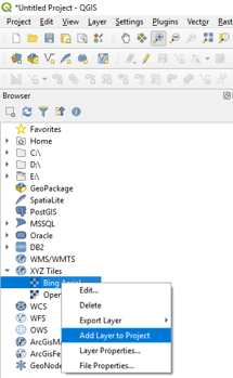
- Open aerial imagery by right clicking the relevant service link and selecting Add Layer to Project.


