Tutorial M07 Check Files QGIS GPKG: Difference between revisions
Jump to navigation
Jump to search
Content deleted Content added
| Line 13: | Line 13: | ||
<ol> |
<ol> |
||
<li>Open the file, either: |
<li>Open the file, either: |
||
:*Within the QGIS Browser Panel, navigate to '''Module_07\TUFLOW\check\M07_5m_001_Check.gpkg''' and double click the following layer, or |
|||
::*'''M07_5m_001_grd_check_R''' |
|||
<li>Within the QGIS Browser Panel, navigate to '''Module_07\TUFLOW\check\M07_5m_001_Check.gpkg''' and double click on the layer to open them.</ol> |
|||
:*In File Explorer, navigate to the '''Module_07\TUFLOW\check''' folder, drag and drop the '''M07_5m_001_Check.gpkg''' into the QGIS workspace and select the layer above. |
|||
<li>Use the 'Apply TUFLOW Styles to Open Layers'. |
<li>Use the 'Apply TUFLOW Styles to Open Layers'. |
||
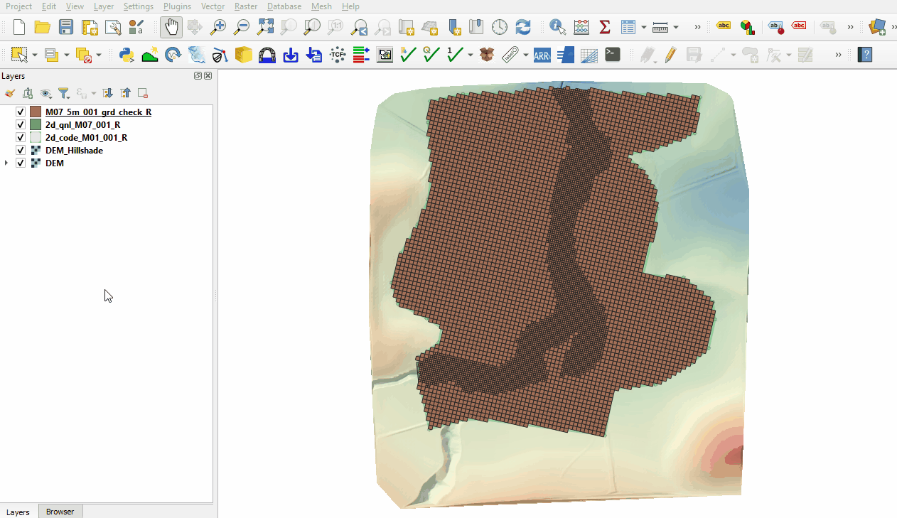
<li>The grd_check is the 2D grid defined by the 2d_code and 2d_qnl layers, it contains a region object for each cell. It is useful to understand how the model is orientated, the cell size in relation to the hydraulic features and where certain calculations occur in the model. In this tutorial, the level 1 grid cell size is 10m, the level 2 grid cell size is 5m.<br> |
<li>The grd_check is the 2D grid defined by the 2d_code and 2d_qnl layers, it contains a region object for each cell. It is useful to understand how the model is orientated, the cell size in relation to the hydraulic features and where certain calculations occur in the model. In this tutorial, the level 1 grid cell size is 10m, the level 2 grid cell size is 5m.<br> |
||
Revision as of 10:49, 31 July 2023
Page Under Construction
Introduction
QGIS is used to import the check files and review the quadtree nesting.
Method
This tutorial introduces:
Review the check files:
- Open the file, either:
- Within the QGIS Browser Panel, navigate to Module_07\TUFLOW\check\M07_5m_001_Check.gpkg and double click the following layer, or
- M07_5m_001_grd_check_R
- In File Explorer, navigate to the Module_07\TUFLOW\check folder, drag and drop the M07_5m_001_Check.gpkg into the QGIS workspace and select the layer above.
- Use the 'Apply TUFLOW Styles to Open Layers'.
- The grd_check is the 2D grid defined by the 2d_code and 2d_qnl layers, it contains a region object for each cell. It is useful to understand how the model is orientated, the cell size in relation to the hydraulic features and where certain calculations occur in the model. In this tutorial, the level 1 grid cell size is 10m, the level 2 grid cell size is 5m.

Conclusion
- The grd_check file was imported to display the quadtree nesting.
| Up |
|---|