TUFLOW SWMM Tutorial M02 Results QGIS: Difference between revisions
Jump to navigation
Jump to search
Content deleted Content added
Chris Huxley (talk | contribs) Created page with "==QGIS Result Viewing== <ol> <li>Open TUFLOW Viewer from the TUFLOW Plugin toolbar.<br> <br> File:tuflow_plugin_tuflow_viewer.png<br> <br> <li>Open the simulation results...." |
Chris Huxley (talk | contribs) No edit summary |
||
| Line 5: | Line 5: | ||
[[File:tuflow_plugin_tuflow_viewer.png]]<br> |
[[File:tuflow_plugin_tuflow_viewer.png]]<br> |
||
<br> |
<br> |
||
<li>Open the simulation results. |
<li>Open the simulation results. Select File > 'Load Results'. Navigate to the '''TUFLOW\runs''' folder and select '''TS02_5m_001.tcf'''. |
||
will load to the Layers Panel: |
|||
:* Open 1D and 2D results: Select File > 'Load Results'. Navigate to the '''TUFLOW\runs''' folder and select '''TS02_5m_001.tcf'''. |
|||
| ⚫ | |||
:* Open 1D (no 2D results): Select File > 'Load Results - Time Series'. Navigate to the '''TUFLOW\results''' folder and select '''TS02_5m_001_swmm_ts.gpkg'''. |
|||
<li> The video example below opens the 1D and 2D results, using the first of the above options. When asked "Do you want to open result GIS layer?", select Yes. Five new files will load to the Layers Panel: |
|||
| ⚫ | |||
:*'''TS02_5m_001_swmm_ts_L''': 1D SWMM conduit flow results |
:*'''TS02_5m_001_swmm_ts_L''': 1D SWMM conduit flow results |
||
:*'''TS02_5m_001_PLOT_P''': 1D ESTRY and 2D plot output water level and velocity results ('''Note:''' There are no ESTRY results from this simulation) |
:*'''TS02_5m_001_PLOT_P''': 1D ESTRY and 2D plot output water level and velocity results ('''Note:''' There are no ESTRY results from this simulation) |
||
:*'''TS02_5m_001_PLOT_L''': 1D ESTRY and 2D plot output flow results ('''Note:''' There are no ESTRY results from this simulation) |
:*'''TS02_5m_001_PLOT_L''': 1D ESTRY and 2D plot output flow results ('''Note:''' There are no ESTRY results from this simulation) |
||
:*'''TS02_5m_001''': 2D TUFLOW Results |
:*'''TS02_5m_001''': 2D TUFLOW Results |
||
<br> |
|||
{{Video|name=Animation_TS1_Results_01a.mp4|width=1350}}<br> |
|||
<li>In the QGIS Layers Panel, select (left click) '''TS02_5m_001''' to establish it as the active dataset. Click on a scalar dataset 'Depth' under the Result Type in the TUFLOW Viewer 'Map Outputs' list. Move the time slider to observe how the results vary at different times during the simulation.<br> |
|||
'''Note:''' The styling of the Map Outputs can be changed by right clicking on each result dataset and editing the 'Properties'. |
|||
<br><br> |
<br><br> |
||
{{Video|name=Animation_TS1_Results_02a.mp4|width=1350}}<br> |
|||
==Pipe Flow Results== |
|||
<li>In the TUFLOW Viewer Panel, set the time to '00:05:00.00'. |
|||
<li>In the QGIS Layers Panel, right click '''TS02_5m_001_swmm_ts_L''' and select 'Zoom to Layer(s)'. |
<li>In the QGIS Layers Panel, right click '''TS02_5m_001_swmm_ts_L''' and select 'Zoom to Layer(s)'. |
||
<li>Use the 'Select Features' tool to highlight pipes within the network. Hold Shift in on the keyboard to enable selection of multiple objects. |
|||
<li>Right click '''TS02_5m_001_swmm_ts_L''' again, and select 'Show Labels'. |
|||
<li>Use the 'Select Features' tool to highlight all items included in '''TS02_5m_001_swmm_ts_L'''. |
|||
<li>Click on the 'Flow' dataset under the Result Type in the TUFLOW Viewer 'Time Series' list. |
<li>Click on the 'Flow' dataset under the Result Type in the TUFLOW Viewer 'Time Series' list. |
||
'''<<video>>''' |
|||
<li>Tick on 'Show Current Time'. |
|||
<li>In the QGIS Layers Panel, right click '''TS02_5m_001_swmm_ts_P''' and select 'Zoom to Layer(s)'. |
|||
<br><br> |
|||
<li>Use the 'Select Features' tool to highlight node junctions within the network. Hold Shift in on the keyboard to enable selection of multiple objects. |
|||
{{Video|name=Animation_TS1_Results_03a.mp4|width=1350}}<br> |
|||
<li>Click on the 'Lateral Inflow' and 'Total Flow' dataset under the Result Type in the TUFLOW Viewer 'Time Series' list. |
|||
:: 'Lateral Inflow' represents the flow entering the network via the 1D/2D pit connection with the surface. |
|||
:: 'Total Inflow' is the sum of all flows, including flows from the 1D/2D pit and upstream 1D pipe connections |
|||
'''<<video>>''' |
|||
</ol> |
</ol> |
||
| Line 33: | Line 32: | ||
== |
==Pipe Long-section Results== |
||
{{Tips Navigation |
{{Tips Navigation |
||
Revision as of 15:33, 18 December 2023
QGIS Result Viewing
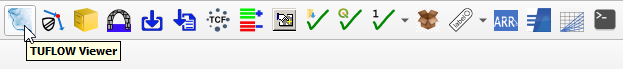
- Open TUFLOW Viewer from the TUFLOW Plugin toolbar.
- Open the simulation results. Select File > 'Load Results'. Navigate to the TUFLOW\runs folder and select TS02_5m_001.tcf.
will load to the Layers Panel:
- TS02_5m_001_swmm_ts_P: 1D SWMM node junction and outlet water level results
- TS02_5m_001_swmm_ts_L: 1D SWMM conduit flow results
- TS02_5m_001_PLOT_P: 1D ESTRY and 2D plot output water level and velocity results (Note: There are no ESTRY results from this simulation)
- TS02_5m_001_PLOT_L: 1D ESTRY and 2D plot output flow results (Note: There are no ESTRY results from this simulation)
- TS02_5m_001: 2D TUFLOW Results
Pipe Flow Results
- In the QGIS Layers Panel, right click TS02_5m_001_swmm_ts_L and select 'Zoom to Layer(s)'.
- Use the 'Select Features' tool to highlight pipes within the network. Hold Shift in on the keyboard to enable selection of multiple objects.
- Click on the 'Flow' dataset under the Result Type in the TUFLOW Viewer 'Time Series' list. <<video>>
- In the QGIS Layers Panel, right click TS02_5m_001_swmm_ts_P and select 'Zoom to Layer(s)'.
- Use the 'Select Features' tool to highlight node junctions within the network. Hold Shift in on the keyboard to enable selection of multiple objects.
- Click on the 'Lateral Inflow' and 'Total Flow' dataset under the Result Type in the TUFLOW Viewer 'Time Series' list.
- 'Lateral Inflow' represents the flow entering the network via the 1D/2D pit connection with the surface.
- 'Total Inflow' is the sum of all flows, including flows from the 1D/2D pit and upstream 1D pipe connections

Pipe Long-section Results
| Up |
|---|