Tutorial M03 Results QGIS: Difference between revisions
Jump to navigation
Jump to search
Content deleted Content added
Created page with "= Introduction = QGIS is used to view the 1D time series results with the TUFLOW Viewer. For viewing of the 2D map results, see <u> Module 1</u>..." |
No edit summary |
||
| Line 1: | Line 1: | ||
= Introduction = |
= Introduction = |
||
QGIS is used to view the 1D time series results with the TUFLOW Viewer. For viewing of the 2D map results, see <u>[[ |
QGIS is used to view the 1D time series results with the TUFLOW Viewer. For viewing of the 2D map results, see <u>[[Tutorial_M01#Results | Module 1]]</u>.<br> |
||
<br> |
<br> |
||
Revision as of 00:05, 11 May 2022
Introduction
QGIS is used to view the 1D time series results with the TUFLOW Viewer. For viewing of the 2D map results, see Module 1.
Method
Plot Time Series results through the culverts:
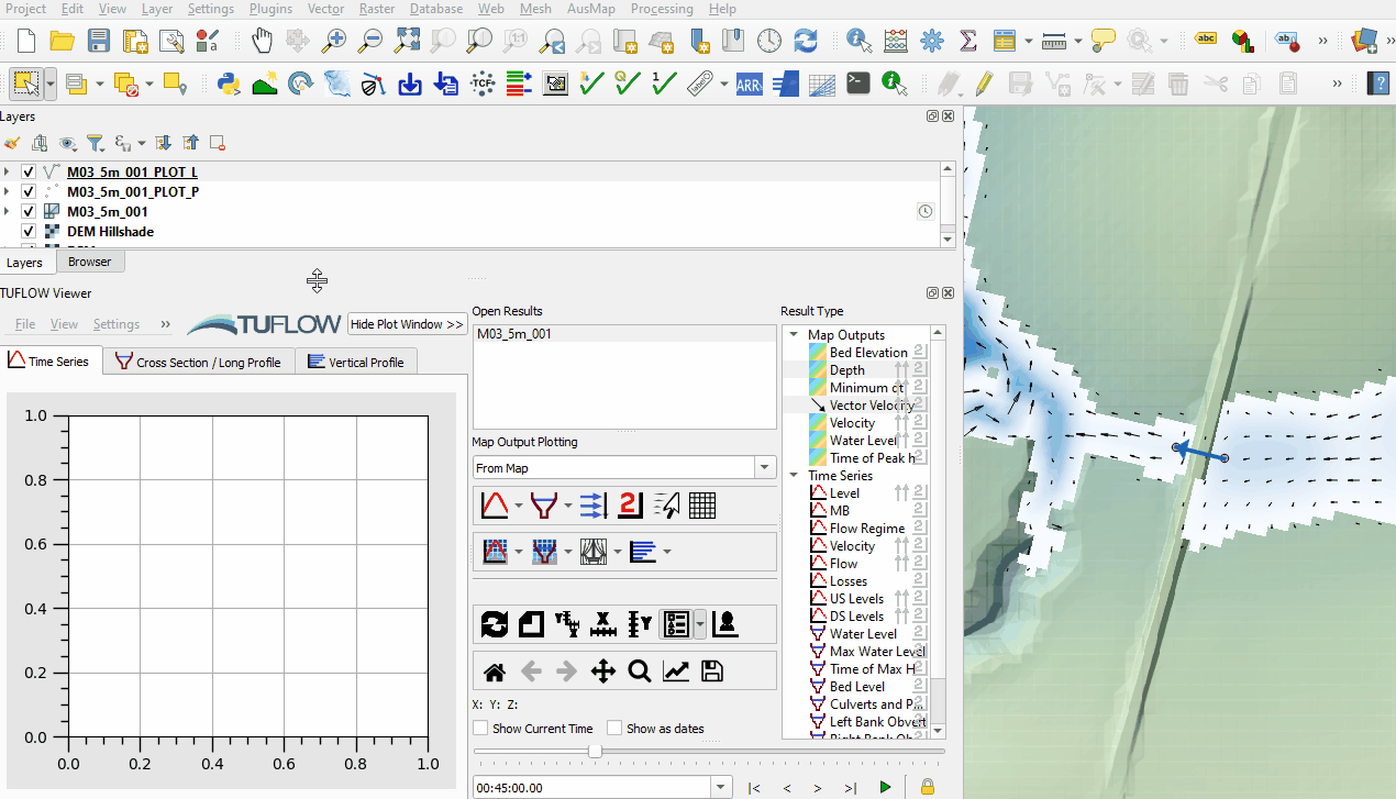
- Open the TUFLOW viewer.
- Select File > Load Results. Navigate to the M03_5m_001.tcf in the Module_03\TUFLOW\runs folder and open it.
- When prompted to 'Open Result GIS Layer', click 'Yes'. This loads in all of the 1D and 2D results.
- Two additional files appear in the Layers panel:
- M03_5m_001_PLOT_L
- M03_5m_001_PLOT_P
- Select the PLOT_L file in the Layers panel and using the 'Select Features' tool highlight one of the 1d_nwk lines.
- Select one of the Time Series datasets shown with the
 icon and the 'Time Series' tab gets updated.

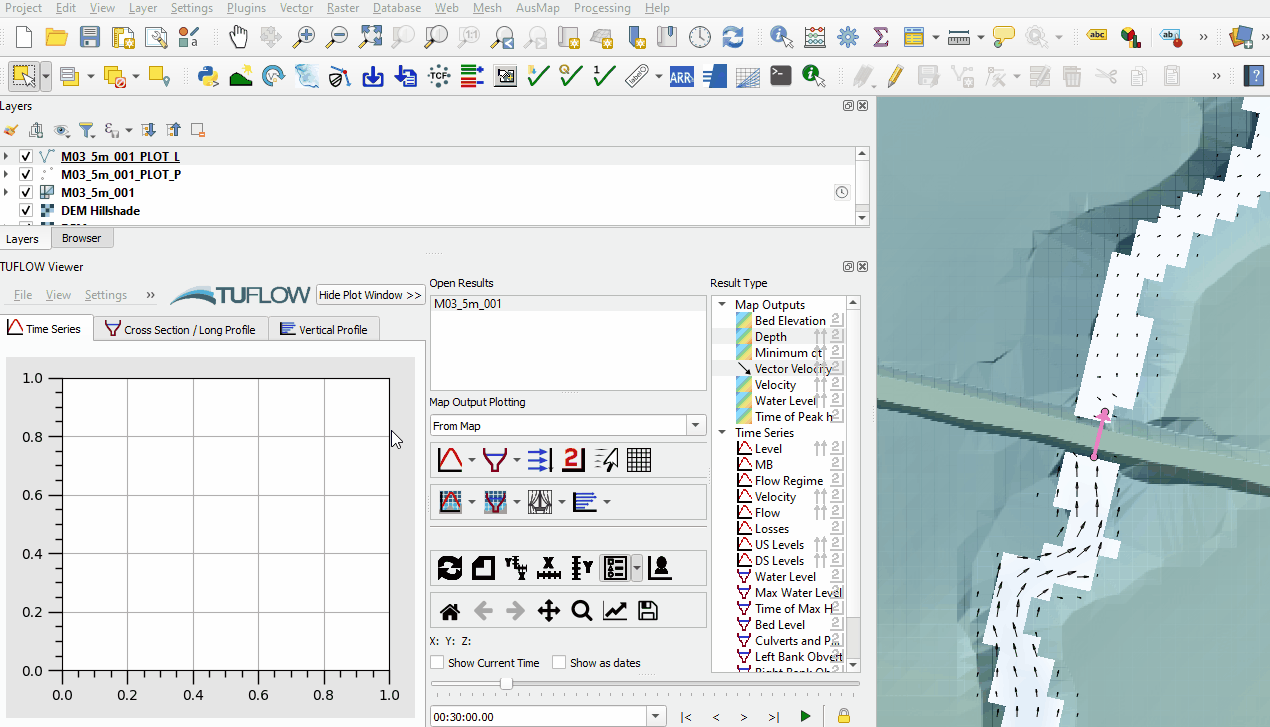
Plot longitudinal profiles from the Time Series output:
- The available long profile result types have a long profile icon
 and display in the 'Cross Section / Long Profile' tab.

Conclusion
- The 1D results were assessed including time series and long profile results.
| Up |
|---|