TUFLOW CATCH Tutorial M01 GIS Inputs QGIS: Difference between revisions
Created page with "= Introduction = QGIS is used to create, import and view input data. = TUFLOW Project Configuration = Configure workspace to set empty file directory???? = Method = A numb..." |
No edit summary |
||
| Line 2: | Line 2: | ||
QGIS is used to create, import and view input data. |
QGIS is used to create, import and view input data. |
||
| ⚫ | |||
= TUFLOW Project Configuration = |
== TUFLOW Project Configuration == |
||
Configure workspace to set empty file directory???? |
Configure workspace to set empty file directory???? |
||
== Supplied Input Files == |
|||
| ⚫ | |||
A number of model input files have been provided in the '''TUFLOW_CATCH_Module_01\Tutorial_Data''' folder. Copy the following GIS files into the '''Modelling\TUFLOW\model\gis''' folder: |
A number of model input files have been provided in the '''TUFLOW_CATCH_Module_01\Tutorial_Data''' folder. Copy the following GIS files into the '''Modelling\TUFLOW\model\gis''' folder: |
||
:*'''2d_bc_TC01_001_L''' |
:*'''2d_bc_TC01_001_L''' |
||
| Line 34: | Line 35: | ||
{{Video|name=}}<br> |
{{Video|name=}}<br> |
||
</ol> |
</ol> |
||
== Receiving Polygon == |
|||
A receiving polygon (2d_rp) is a single polygon that covers the downstream receiving waters. The TUFLOW HPC cells within the polygon will be removed from the TUFLOW HPC simulation. TUFLOW CATCH will write summary timeseries files that describe total water and pollutant mass fluxes entering the polygon. The receiving polygon must encompass the downstream 2d_bc boundary ('''2d_bc_TC01_001_L'''). <br> |
|||
Create the 2d_rp layer using the TUFLOW plugin: |
|||
<ol> |
|||
<li>Click on the 'Import Empty File' symbol from the TUFLOW plugin toolbar. |
|||
:* Select 2d_rp from the |
|||
Revision as of 15:18, 19 March 2025
Introduction
QGIS is used to create, import and view input data.
Method
TUFLOW Project Configuration
Configure workspace to set empty file directory????
Supplied Input Files
A number of model input files have been provided in the TUFLOW_CATCH_Module_01\Tutorial_Data folder. Copy the following GIS files into the Modelling\TUFLOW\model\gis folder:
- 2d_bc_TC01_001_L
- 2d_mat_TC01_001_R
- 2d_bc_M03_culverts_001_P
- 2d_bc_M03_culverts_001_L
- 2d_bc_M03_culverts_001_R
- 1d_nwk_M03_culverts_001_L
Investigate the supplied files:
- In Windows File Explorer, navigate to the Modelling\TUFLOW\model\gis folder. Drag and drop the above layers into QGIS.
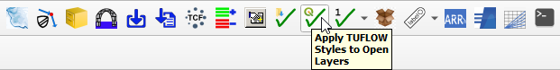
- Click on the 'Apply TUFLOW Styles to Open Layers' symbol from the TUFLOW Plugin toolbar.
- The 2d_bc_TC01_001_L layer contains the downstream boundary:
- It is a stage-discharge (HQ) boundary with a 1% water surface slope
- This layer contains the downstream boundary from TUFLOW Tutorial Module 1. The upstream boundary was removed as TUFLOW CATCH does not support source??.
- The 2d_mat_TC01_001_R layer contains the spatial definition of material types:
- It is a supplementary material file to 2d_mat_M01_001_R, which is used in the TUFLOW tutorials. For more information, refer to TUFLOW Tutorial Module 1.
- The material file is supplied with a QGIS style file (.qml) and displays the different material groups based on the Material ID.
- explain the materials more? or just show in vid
- The other supplied layers represent culverts. For more information, refer to TUFLOW Tutorial Module 3.

Receiving Polygon
A receiving polygon (2d_rp) is a single polygon that covers the downstream receiving waters. The TUFLOW HPC cells within the polygon will be removed from the TUFLOW HPC simulation. TUFLOW CATCH will write summary timeseries files that describe total water and pollutant mass fluxes entering the polygon. The receiving polygon must encompass the downstream 2d_bc boundary (2d_bc_TC01_001_L).
Create the 2d_rp layer using the TUFLOW plugin:
- Click on the 'Import Empty File' symbol from the TUFLOW plugin toolbar.
- Select 2d_rp from the