Arc Reproject Data: Difference between revisions
Jump to navigation
Jump to search
Content deleted Content added
Chris Huxley (talk | contribs) |
Chris Huxley (talk | contribs) |
||
| Line 6: | Line 6: | ||
ArcToolbox>> Data Management>>Projections and Transformations>>Feature>>Batch Project <br> |
ArcToolbox>> Data Management>>Projections and Transformations>>Feature>>Batch Project <br> |
||
[[File:Arc_Project_001.PNG| |
[[File:Arc_Project_001.PNG|200px]] <br><br> |
||
Single files can be re-projection using the "Project" tool. <br> |
Single files can be re-projection using the "Project" tool. <br> |
||
[[File:Arc_Project_002. |
[[File:Arc_Project_002.png|200px]] <br><br> |
||
Multiple files can be re-projection using the "Batch Project" tool. <br> |
Multiple files can be re-projection using the "Batch Project" tool. <br> |
||
[[File:Arc_Project_003. |
[[File:Arc_Project_003.png|200px]] <br> |
||
<br> |
<br> |
||
Revision as of 05:05, 3 March 2015
Introduction
GIS data can re-projected to a different co-ordinate system using ArcGIS.
Method
The file re-projection tool is contained within the ArcToolbox
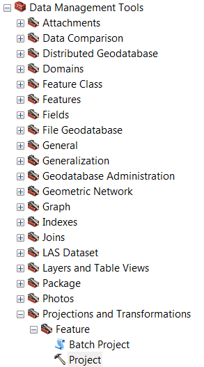
ArcToolbox>> Data Management>>Projections and Transformations>>Feature>>Batch Project

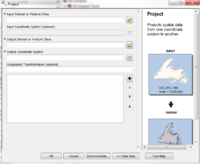
Single files can be re-projection using the "Project" tool.

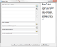
Multiple files can be re-projection using the "Batch Project" tool.

| Up |
|---|