Search results
Jump to navigation
Jump to search
Page title matches
- This page details the method for using QGIS to create the GIS based material types (land use areas). Once the GIS layer The '''Module_Data\Module_01\QGIS\''' folder already contains the materials files that we will use.5 KB (799 words) - 12:45, 9 January 2023
Page text matches
File:Tute M01 QGIS 2d mat2.png Tute M01: QGIS materials step 2.(325 × 399 (18 KB)) - 14:31, 28 December 2011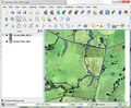
File:Tute M01 QGIS 2d mat 01.JPG Tute M01 Materials layer in QGIS, no style applied.(744 × 616 (130 KB)) - 11:51, 6 September 2013- QGIS will be used to import the check files and view the final elevations in the ...''TUFLOW\check\2d\''' folder. This can either be dragged and dropped into QGIS, or can be loaded by selecting ''Layer >> Add Layer >> Add raster layer fro2 KB (328 words) - 13:26, 5 April 2024
- This page details the method for using QGIS to create the GIS based material types (land use areas). Once the GIS layer The '''Module_Data\Module_01\QGIS\''' folder already contains the materials files that we will use.5 KB (799 words) - 12:45, 9 January 2023
- :* TUFLOW Materials File (materials)<br> [[File:Tute M01 Directory Structure v3.png|left]]33 KB (5,505 words) - 15:53, 20 February 2024
- <li> TUFLOW Materials File (.csv)<br> [[File:Tute M01 Directory Structure v3.png|left|frame]]53 KB (8,955 words) - 11:34, 5 April 2024

