Uncategorized files
Jump to navigation
Jump to search
Showing below up to 50 results in range #1,851 to #1,900.
-
Deactivate 2D Cells SHP v2.mp4 1 min 45 s, 1920x1038; 57.81 MB
-
Deactivate 2D cells GPKG.mp4 3 min 44 s, 1920x1080; 69.56 MB
-
Deactivate 2D cells SHP.mp4 1 min 59 s, 1920x1080; 89.47 MB
-
Define 1D 2D Bdy Links 01 GPKG.mp4 2 min 47 s, 1916x1024; 49.05 MB
-
Define 1D 2D Bdy Links 01 SHP.mp4 1 min 30 s, 1916x1022; 47.13 MB
-
Define 1D 2D Bdy Links 02 SHP.mp4 4 min 56 s, 1914x1022; 79.05 MB
-
Define Bank Elevations GPKG.mp4 3 min 8 s, 1920x1080; 56.12 MB
-
Define Bank Elevations SHP.mp4 1 min 48 s, 1916x1038; 47.99 MB
-
Define Boundary Conditions Module 02 QGIS GPKG.mp4 2 min 38 s, 1920x1020; 46.31 MB
-
Define Boundary Conditions Module 02 QGIS SHP.mp4 3 min 14 s, 1918x1022; 52.88 MB
-
Define Elevations Module 02 QGIS GPKG.mp4 46 s, 1910x1024; 19.06 MB
-
Define External 1D Networks GPKG.mp4 1 min 36 s, 1920x1080; 26.29 MB
-
Define External 1D Networks GPKG v2.mp4 1 min 6 s, 1920x1080; 17.86 MB
-
Define External 1D Networks GPKG v3.mp4 51 s, 1918x1026; 18.49 MB
-
Define External 1D Networks SHP.mp4 34 s, 1914x1022; 15.96 MB
-
Define Pipe Network Module 02 QGIS GPKG.mp4 4 min 47 s, 1918x1022; 87.41 MB
-
Define Pipe Network Module 02 QGIS SHP.mp4 4 min 57 s, 1914x1022; 93.97 MB
-
Define Surface Roughness Module 02 QGIS GPKG.mp4 1 min 42 s, 1918x1020; 35.39 MB
-
Define Surface Roughness Module 02 QGIS SHP.mp4 1 min 52 s, 1920x1022; 38.46 MB
-
Define the Water Level Lines GPKG.mp4 1 min 28 s, 1912x1030; 34.19 MB
-
Define the Water Level Lines SHP.mp4 1 min 25 s, 1916x1024; 35.96 MB
-
 Delete selected features icon.png 26 × 27; 684 bytes
-
 Depth-discharge pump.PNG 898 × 183; 12 KB
-
 Depth res M01.jpeg 1,882 × 841; 286 KB
-
 Determination of grating type.jpg 1,052 × 107; 22 KB
-
 Dialogue box 1.png 821 × 118; 33 KB
-
 Diff TF versions.JPG 230 × 87; 12 KB
-
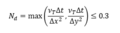 Diffusion Number Equation.PNG 256 × 70; 3 KB
-
 Disable network drive 02.png 479 × 92; 6 KB
-
 Disable network drive 03.png 389 × 630; 121 KB
-
 Domain-rotation-atorigin-comparison.PNG 1,083 × 589; 244 KB
-
 Domcheck.png 870 × 579; 48 KB
-
 Download Selection3.png 236 × 163; 7 KB
-
 Download Settings.png 276 × 209; 8 KB
-
 Download data.png 160 × 130; 4 KB
-
 Downstream junctions to outfalls dialog.png 682 × 547; 27 KB
-
 Downstream junctions to outfalls output options.png 682 × 547; 30 KB
-
 Downstream junctions to outfalls output options 2.png 602 × 158; 6 KB
-
 Downstream junctions to outfalls output options 3.png 658 × 229; 9 KB
-
 Dt sync.png 620 × 227; 19 KB
-
 Dt timeseries.png 475 × 281; 7 KB
-
 EG17 001.png 698 × 99; 8 KB
-
 EG17 AD 001.png 744 × 121; 10 KB
-
 EG17 AD Consit 001.png 1,167 × 59; 6 KB
-
 EG17 conc 001.png 533 × 300; 13 KB
-
 ERROR1061.JPG 839 × 90; 27 KB
-
 ERROR2012 Check Mats.png 1,089 × 664; 77 KB
-
 ERROR 2135 002.JPG 931 × 408; 77 KB
-
 ESTRY to SWMM dialog.png 1,174 × 979; 84 KB
-
 ET Geo Wizard 000.PNG 1,250 × 780; 143 KB


