Unused files
The following files exist but are not embedded in any page. Please note that other websites may link to a file with a direct URL, and so may still be listed here despite being in active use.
Showing below up to 50 results in range #51 to #100.
-
 Check Files Str Grp 001.png 781 × 143; 10 KB
-
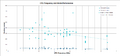 CPUfrq5.png 1,650 × 775; 55 KB
-
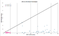 CPUvsGPU5.png 1,377 × 832; 39 KB
-
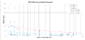 GPUvsCUDA5.png 1,652 × 780; 54 KB
-
 TUFLOW Empty File ZShape Format.PNG 505 × 307; 8 KB
-
 Nvidia-smi 001.png 477 × 247; 30 KB
-
 Nvidia-smi 002.png 980 × 514; 10 KB
-
 Nvidia-smi 003.png 981 × 514; 12 KB
-
 Nvidia-smi 004.png 1,159 × 609; 207 KB
-
 Mainpage TUFLOW Manual 003.PNG 1,515 × 852; 896 KB
-
 Mainpage TUFLOW Release Notes 001.PNG 1,279 × 717; 360 KB
-
 Mainpage TUFLOW Installer Logo 001.PNG 889 × 499; 29 KB
-
 Wiki Homepage Free v2.PNG 1,517 × 853; 15 KB
-
 Osgeo4w advanced.png 461 × 297; 4 KB
-
 Osgeo4w install.png 355 × 243; 5 KB
-
 Osgeo4w qgis-ltr.PNG 974 × 356; 18 KB
-
 Osgeo4w matplotlib.PNG 651 × 204; 9 KB
-
 PRANDTL.png 270 × 60; 2 KB
-
 Osgeo4w download.PNG 441 × 173; 10 KB
-
 Osgeo4w executable.PNG 802 × 472; 31 KB
-
 Osgeo4w install 1.PNG 656 × 465; 21 KB
-
 Osgeo4w install 2.PNG 655 × 464; 14 KB
-
 Osgeo4w install 3.PNG 656 × 465; 21 KB
-
 Osgeo4w install 4.PNG 656 × 467; 15 KB
-
 Osgeo4w install 5.PNG 657 × 465; 14 KB
-
 Osgeo4w install 6.PNG 656 × 465; 15 KB
-
 Osgeo4w install 7.PNG 987 × 628; 58 KB
-
 Osgeo4w install 8.PNG 991 × 628; 51 KB
-
 Osgeo4w install 10.PNG 990 × 628; 51 KB
-
 Osgeo4w install 9.PNG 990 × 630; 55 KB
-
 Osgeo4w install 11.PNG 847 × 627; 32 KB
-
 Qgis dev startmenu.PNG 395 × 491; 174 KB
-
 Qgis dev folderlocation.PNG 812 × 607; 56 KB
-
 Osgeo4w update.PNG 325 × 552; 23 KB
-
 Webinar Calibration.PNG 1,141 × 641; 333 KB
-
 QGIS Instalation Guide Youtube Picture.jpg 3,000 × 1,688; 242 KB
-
 LoadingResultsTCF.gif 1,176 × 662; 740 KB
-
 Software Licence 001.PNG 877 × 713; 103 KB
-
 Software Licence 004.PNG 1,122 × 790; 83 KB
-
 Software Licence 003.PNG 1,126 × 795; 124 KB
-
 Software Licence 002.PNG 1,122 × 793; 130 KB
-
 1d2ddt.png 1,391 × 611; 34 KB
-
 TUFLOW Output Advice.jpg 1,330 × 748; 126 KB
-
 Fig7 porosity sens.png 1,000 × 1,000; 290 KB
-
 Fig6 hydroconduct.png 1,000 × 1,000; 263 KB
-
 Fig10 GA soils.png 1,000 × 1,000; 406 KB
-
 Fig1.jpeg 1,000 × 1,000; 98 KB
-
 Init moisture F11 catchment.png 811 × 837; 314 KB
-
 1d nwk pump SX node.PNG 488 × 641; 19 KB
-
 Osgeo4w install 10b.PNG 903 × 667; 213 KB


