1D Integrity Tool - Tutorial
Introduction
The 1D Integrity Tool is a suite of tools that help modellers find and fix potential errors in 1D networks prior to running TUFLOW. The tool was primarily designed for sub-surface pipe drainage networks, but can be used for all 1D channel types, however not all checks will be available. The tool is designed to be fast and provide automated fixes as well as visualisations to help the process. The 1D Integrity Tool is a free tool that comes as part of the TUFLOW plugin in QGIS.
The 1D Integrity tool is designed to accept multiple inputs and will treat all inputs holistically as a complete system. Each tool is designed to be run separately and progressively as part of the entire tool suite. It is assumed that most of the channel attribute data has been populated, most importantly that each channel has been given a valid type.
The following exercises will take the user through the various tools using a pipe drainage network which contains a number of common errors which are found in these types of datasets.
Loading the Data
- Firstly download the tutorial dataset from the following link and unzip the dataset.
- From the Integrity_Tool_Tutorial\Datafolder load the 1d_nwk_MI01_Pipes_001_L.shp , 1d_nwk_MI01_Pipes_001_L.shp and dem_DEV_EG07 into QGIS.
- Review the dataset and use the ‘Apply TUFLOW Styles to open layers’ tool,
 , to theme the data.
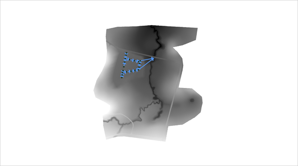
This is a small sub-surface drainage network model. This example will showcase use of the tools to check the integrity of such a dataset, however the tool really comes into it’s own when assessing much larger datasets where checking things manually would be a time-consuming task.
- From the TUFLOW plugin, open the 1D Integrity tool.
- Input Network Lines - input location of 1d_nwk lines such as pipes, culverts, and open channels. Use dropdown box and '+' button to add layers as inputs to tool.
- Input Network Points - input location of 1d_nwk points such as pits and nodes. Use dropdown box and '+' button to add layers as inputs to tool.
- Input Tables - input location of 1d_ta lines such as 1d_xs, 1d_cs, and 1d_hw. Use dropdown box and '+' button to add layers as inputs to tool.
- Input DEM - input raster. Currently only 1 input is supported, so if you are using tiled rasters datasets, they would need to be mosaiced into a single raster prior to running the tool.
- Tool Selection - the active tab will determine the active tool. Prior to plugin version 3.2 a radio button was used to select the active tool. See Tool Documentation for information on each tool.
- Status Bar - contains the progress bar and status of the integrity tool. Includes information such as the current active task being performed (if one of the tools is running), and the status of the previously run tool.
- Run - runs the currently active tool (active tool determined by the current active tool tab - prior to plugin version 3.2 a radio button was used to select the active tool).
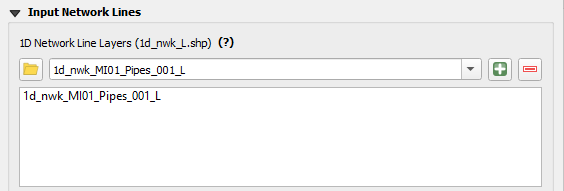
- Within the Input Network Lines tool, select the 1d_nwk_MI01_Pipes_001_L.shp in the dropdown menu and click the ‘+’ icon to add the 1d_nwk_MI01_Pipes_001_L.shp to the list of 1D network lines as below.
This means we will be undertaking the integrity tests on this layer. We could also use the integrity tools on point layers and/or cross-section/Height/Width tables but for the purpose of this demonstration we will only use the network line layers.

 .
.The resulting dialogue will pop up. The numbered fields are described below.

