ARR DATAHUB CANNOT BE ACCESSED
Revision as of 14:59, 30 October 2018 by Ellis Symons (talk | contribs)
Steps
- Run 'Extract ARR2016 for TUFLOW' tool in QGIS until error - This will let the tool download the data from BOM as well as perform the pre-calculations such as extract the catchment area and centroid from the input catchments
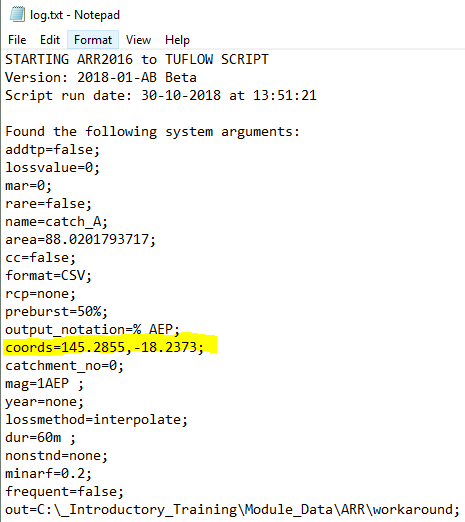
- Open 'log.txt' and extract the longitudinal and latitude values
- Using an internet browser, navigate to the ARR datahub
- Input the coordinates of your catchment
- Tick on the 'Select All' box
- Click Submit
- Navigate to the bottom of the page and click Download TXT
- Create a new .txt file called 'ARR_Web_Data_<catchment name>.txt' - The catchment name should be consistent with the name used in the QGIS tool. It will also be listed in the log.txt after name=
