ARR DATAHUB CANNOT BE ACCESSED
Revision as of 15:38, 30 October 2018 by Ellis Symons (talk | contribs)
Steps
- Run 'Extract ARR2016 for TUFLOW' tool in QGIS until error - This will let the tool download the data from BOM as well as perform the pre-calculations such as extract the catchment area and centroid from the input catchments
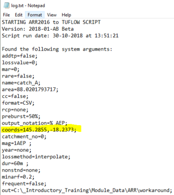
- Open 'log.txt' located in the tool output folder and extract the longitudinal and latitude values
- Using an internet browser, navigate to the ARR datahub
- Input the coordinates of your catchment
- Tick on the 'Select All' box

- Click Submit
- Navigate to the bottom of the page and click Download TXT
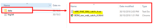
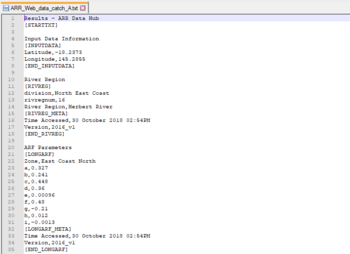
- Create a new .txt file called 'ARR_Web_Data_<catchment name>.txt' and save it in the data folder alongside the existing file 'BOM_raw_web_<catchment name>.html - The catchment name should be consistent with the name used in the QGIS tool. It will be the same as the BOM raw output and also be listed in the log.txt after name=
- Copy the text from the 'Download TXT to the newly created 'ARR_web_data' text file
- On the ARR datahub page, navigate to the temporal patterns and click Download (.zip)

- Extract the contents of the zip file
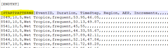
- Open '_increments.csv' in a text editor
- Copy the contents of the csv to the end of 'ARR_Web_data'
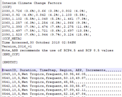
- Infront of 'EventID' in the newly copied across data, insert the following text [STARTPATTERNS]