Difference between revisions of "SMS 3D Animation"
Jump to navigation
Jump to search
| Line 10: | Line 10: | ||
* Aerial Photography; and | * Aerial Photography; and | ||
* Model Results. | * Model Results. | ||
| + | Together with aerial photography, the 2D results for Tutorial Module 3 are used here. The complete model is available from the Downloads section of the <u>[http://www.tuflow.com/ TUFLOW website]</u>. | ||
| + | <br> | ||
| + | ==Creating a 3D Animation== | ||
| + | The 2D results include the ground elevation (.2dm), water level (_h) and velocity (_v) and datasets. The following steps may equally be followed using other datasets you may have. | ||
| − | + | <li>Begin by opening in SMS the ground elevation (.2dm) and 2D results datasets using the '''M03_5m_001.ALL.sup'''results file located in the '''TUFLOW\results\M03\2d''' folder together with the aerial photography '''Aerial_Photo_M01.jpg''' available in the '''Module_Data\Aerial_Photos\SMS''' folder.</li> | |
| + | <li>SMS should now look something like this: | ||
| + | <br> | ||
| + | [[File:SMS 3D AVI 1.png|800px|frame|none|]]</li> | ||
| + | <li>To view the 2D mesh at a pseudo-3D oblique view, open the ''Display Options >> 2D Mesh'' window and check the Elements on. Using the Rotate tool [[File:SMS Rotate Icon.png]] you can drag the map view and change ot an oblique view. | ||
<br> | <br> | ||
| − | + | [[File:SMS 3D AVI 2.png|800px|frame|none|]]</li> | |
| − | + | <li></li> | |
| + | <li></li> | ||
| + | <li></li> | ||
| + | <li></li> | ||
| + | <li></li> | ||
| + | <li></li> | ||
| + | <li></li> | ||
Revision as of 09:56, 11 September 2012
Page Currently Under Construction
- Digital Elevation Model/TIN;
- Aerial Photography; and
- Model Results.
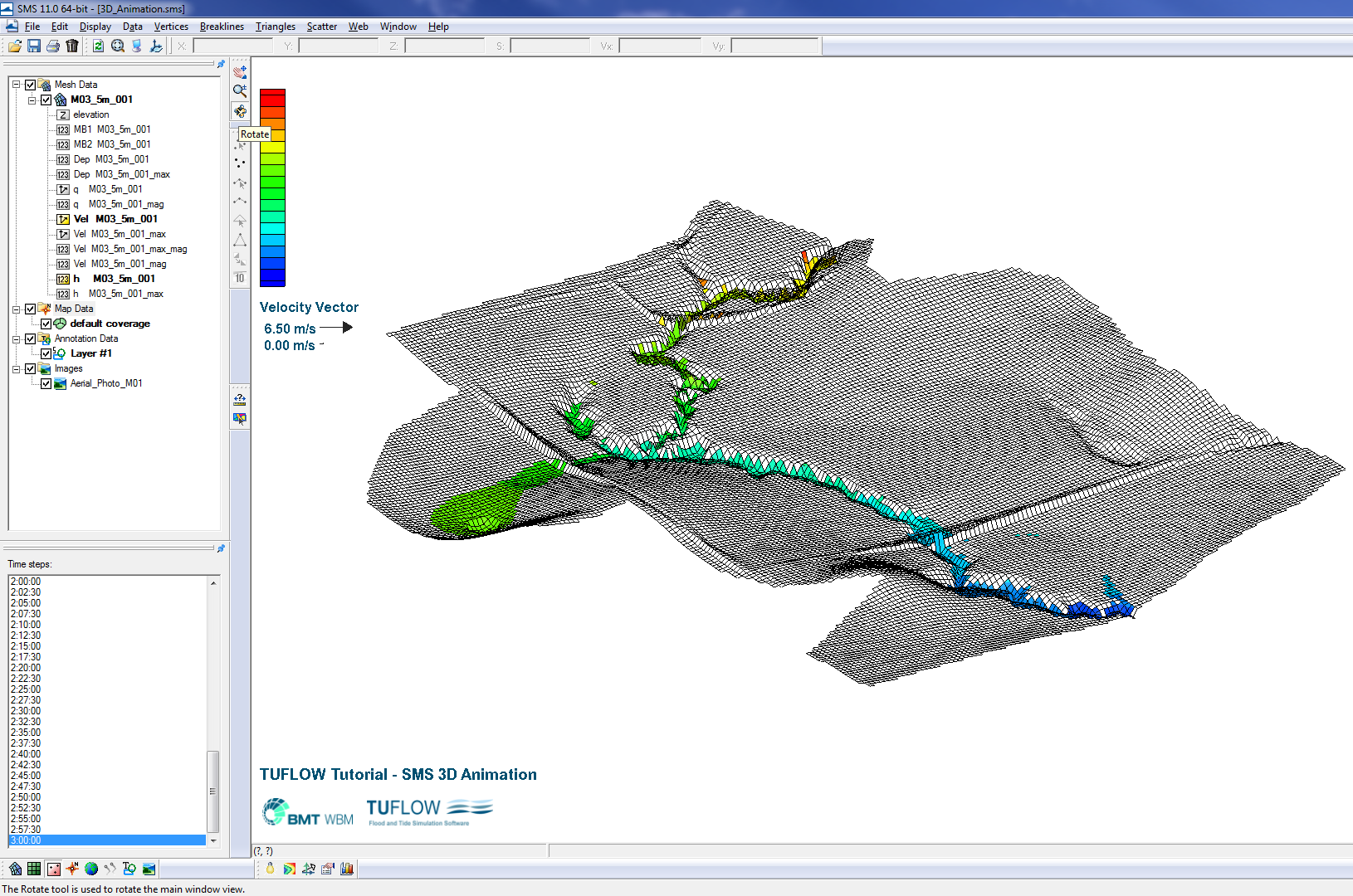
- Begin by opening in SMS the ground elevation (.2dm) and 2D results datasets using the M03_5m_001.ALL.supresults file located in the TUFLOW\results\M03\2d folder together with the aerial photography Aerial_Photo_M01.jpg available in the Module_Data\Aerial_Photos\SMS folder.
- SMS should now look something like this:
- To view the 2D mesh at a pseudo-3D oblique view, open the Display Options >> 2D Mesh window and check the Elements on. Using the Rotate tool
 you can drag the map view and change ot an oblique view.
Introduction
This page explains how to make a 3D animation using the SMS software. SMS version 11.0 has been used for this example, however good results can also be achieved using older versions of SMS. As a minimum you will need a licence for the SMS VIZ edition (see SMS pricing).
Data Required
As a minimum you will need:
Together with aerial photography, the 2D results for Tutorial Module 3 are used here. The complete model is available from the Downloads section of the TUFLOW website.
Creating a 3D Animation
The 2D results include the ground elevation (.2dm), water level (_h) and velocity (_v) and datasets. The following steps may equally be followed using other datasets you may have.
