Uploads by Par
Jump to navigation
Jump to search
This special page shows all uploaded files.
| Date | Name | Thumbnail | Size | Description |
|---|---|---|---|---|
| 12:03, 6 June 2014 | CM CM Stick Red.jpg (file) |  |
1 KB | CM Stick Red |
| 12:03, 6 June 2014 | CM CM Stick Yellow.jpg (file) |  |
1 KB | CM Stick Yellow |
| 16:44, 28 May 2014 | CM Network Client01.jpg (file) |  |
144 KB | CodeMeter - configure network client |
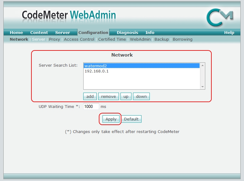
| 16:21, 28 May 2014 | CM Network Server01.jpg (file) |  |
133 KB | CodeMeter - Enabling the Network Server |
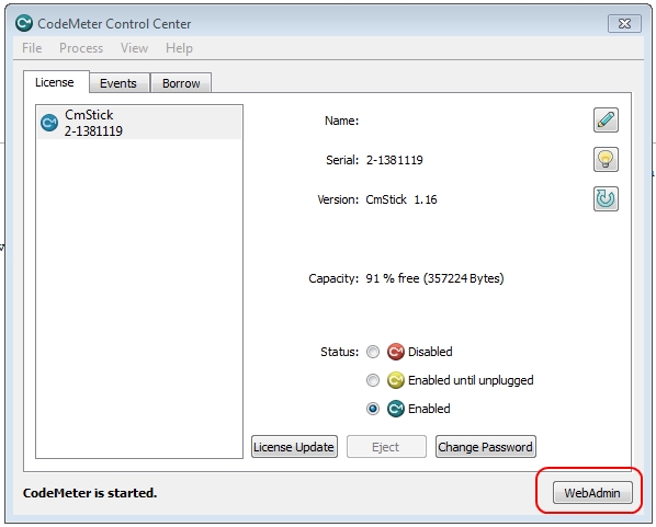
| 16:15, 28 May 2014 | CMCC WebAdmin.jpg (file) |  |
92 KB | Accessing Webadmin from CodeMeter Control Centre |
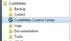
| 16:12, 28 May 2014 | CodeMeter ProgramFiles.jpg (file) |  |
21 KB | Accessing CodeMeter Control Centre from the Start Menu. |
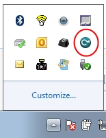
| 16:10, 28 May 2014 | CodeMeter TaskBar.jpg (file) |  |
21 KB | Accessing the CodeMeter Control Centre from the taskbar |
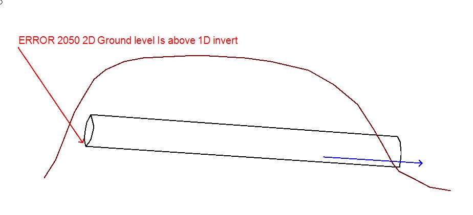
| 13:18, 1 May 2014 | Error 2050 Image01.JPG (file) |  |
34 KB | Error 2050 Image 01 |
| 12:53, 3 April 2014 | Tute M13 results 02.JPG (file) |  |
32 KB | Tute M13: Depths and velocities |
| 12:52, 3 April 2014 | Tute M13 results 01.JPG (file) |  |
32 KB | Tute M13, Elevation and velocites. |
| 12:45, 3 April 2014 | Tute M13 check files1.JPG (file) |  |
78 KB | Tute M13 check files. |
| 12:26, 3 April 2014 | Tute M13 region attributes.JPG (file) |  |
39 KB | Tute M13: Breach region attributes. |
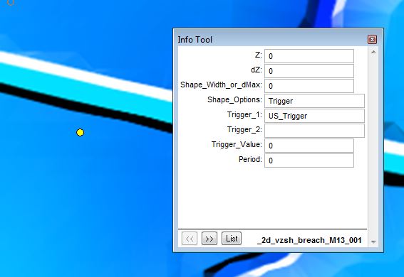
| 12:25, 3 April 2014 | Tute M13 point attributes.JPG (file) |  |
33 KB | Tute M13: Trigger point attributes |
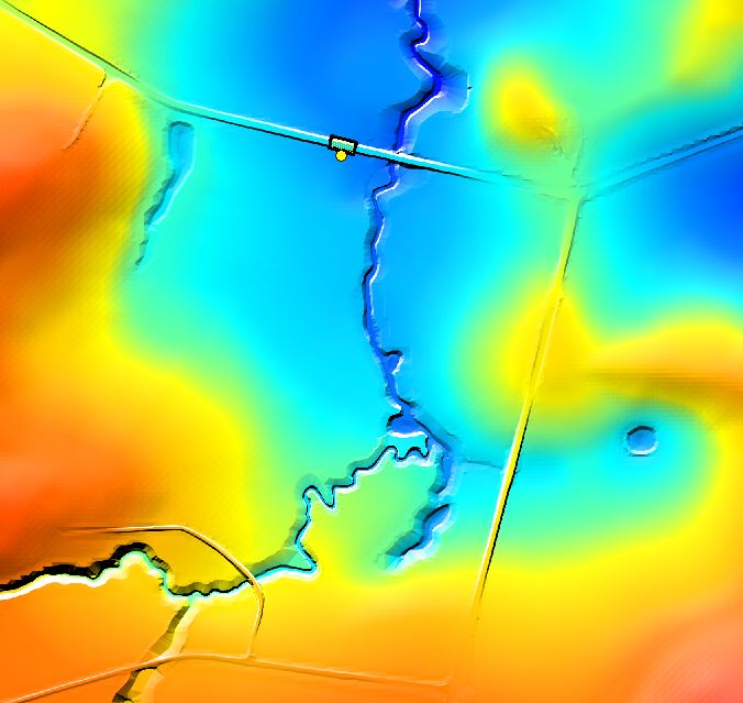
| 12:22, 3 April 2014 | Tute M13 location.JPG (file) |  |
54 KB | Tute M13 Overview of breach location. |
| 08:14, 3 April 2014 | Tute M13 breach location.JPG (file) |  |
40 KB | Tute M13, breach location. |
| 14:58, 21 March 2014 | Arc raster to flt2.jpg (file) |  |
19 KB | Arc Raster to float 2 |
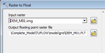
| 14:57, 21 March 2014 | Arc raster to flt1.jpg (file) |  |
55 KB | Arc Raster to Float 1 |
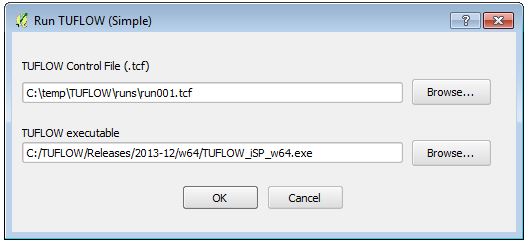
| 10:20, 16 January 2014 | QgisTuflow RunTUFLOW01.JPG (file) |  |
26 KB | TUFLOW QGIS, run a TUFLOW simulation. |
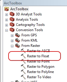
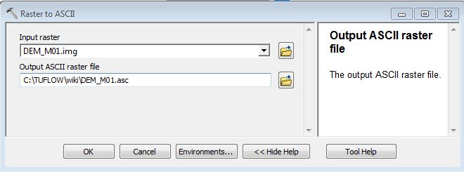
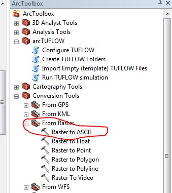
| 08:37, 12 November 2013 | Arc raster to asc 2.jpg (file) |  |
32 KB | Arc Raster to ASCII dialogue. |
| 08:33, 12 November 2013 | Arc raster to asc.jpg (file) |  |
86 KB | Arc GIS, export from raster to .asc format. |
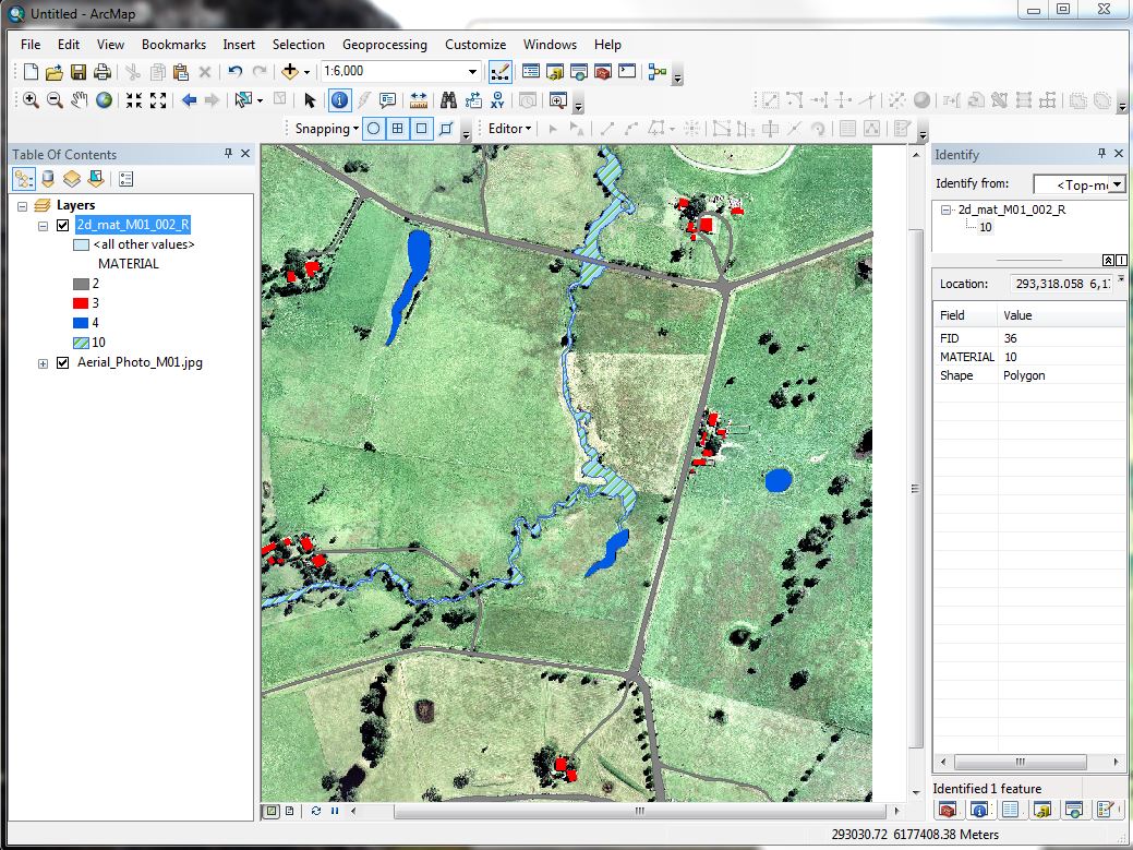
| 12:42, 6 September 2013 | Tute M01 Arc 2d mat 03.JPG (file) |  |
209 KB | Tute M01: Arc, map of materials with symbology. |
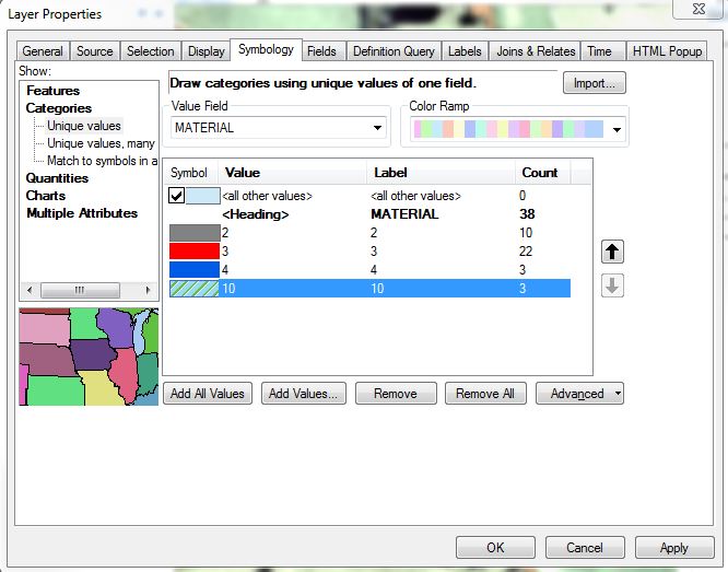
| 12:41, 6 September 2013 | Tute M01 Arc 2d mat 02.JPG (file) |  |
63 KB | Tute M01: Arc, unique symbology. |
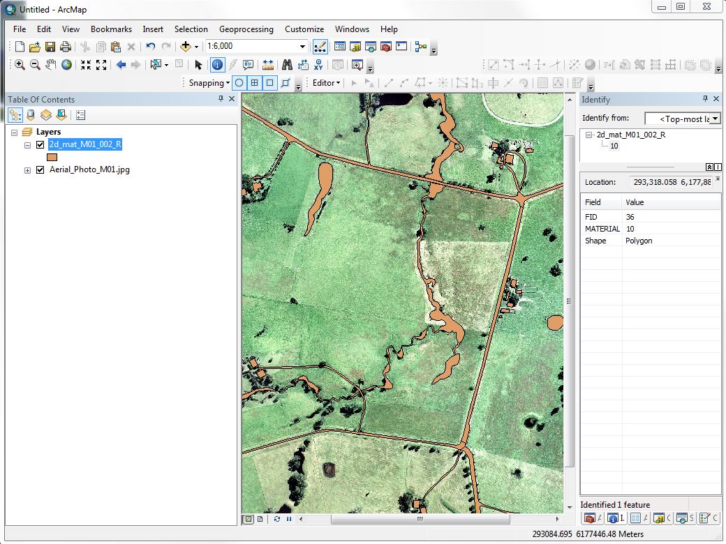
| 12:40, 6 September 2013 | Tute M01 Arc 2d mat 01.JPG (file) |  |
186 KB | Tute M01: Arc, materials no style applied. |
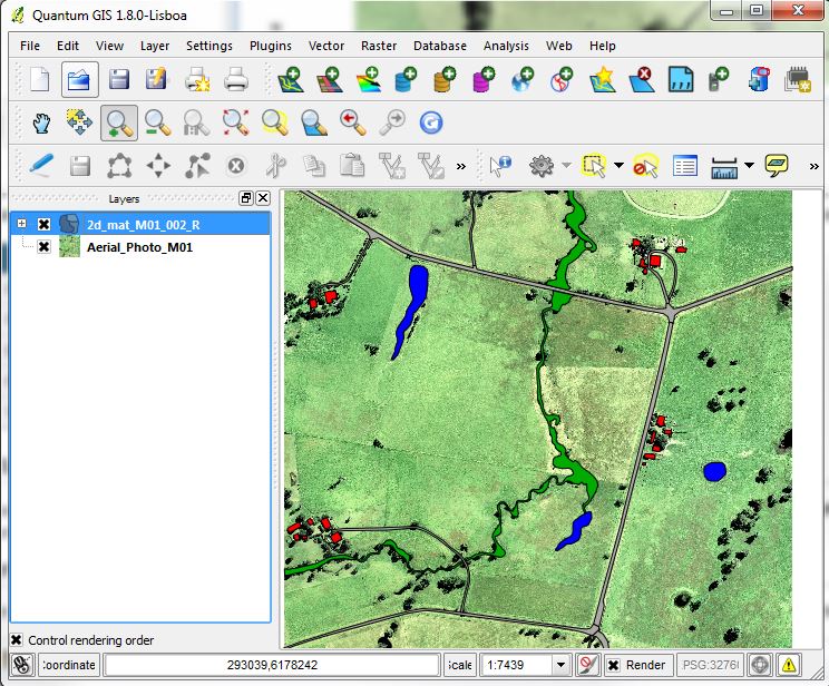
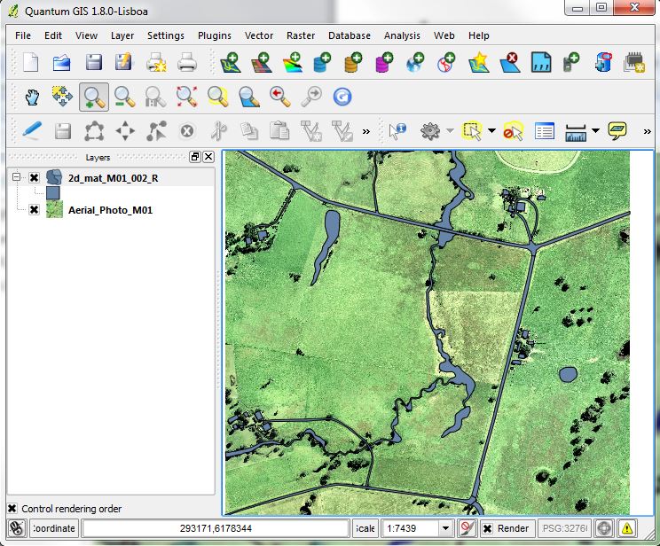
| 11:59, 6 September 2013 | Tute M01 QGIS 2d mat 06.JPG (file) |  |
131 KB | Tute M01: QGIS, map of 2d_mat after style applied. |
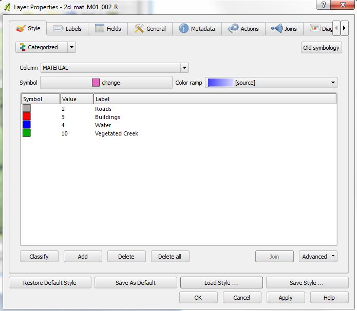
| 11:58, 6 September 2013 | Tute M01 QGIS 2d mat 05.JPG (file) |  |
55 KB | Tute M01: QGIS, 2d_mat styles. |
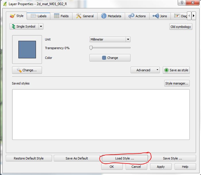
| 11:57, 6 September 2013 | Tute M01 QGIS 2d mat 04.JPG (file) |  |
50 KB | Tute M01: QGIS, loading .qml. |
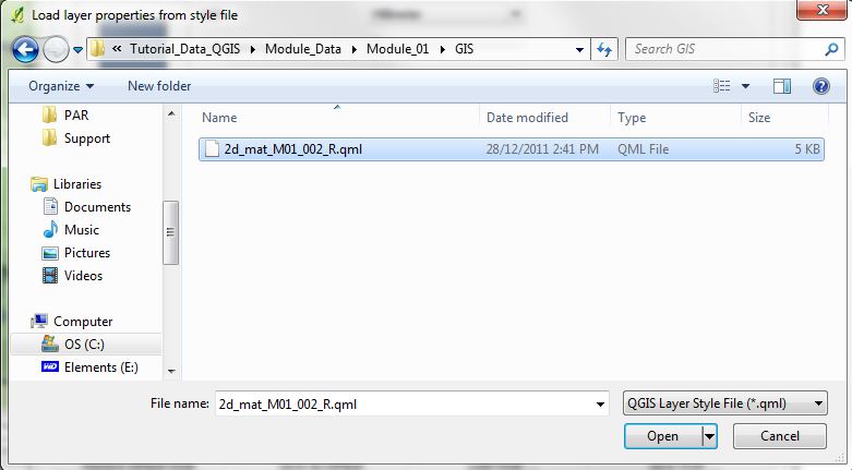
| 11:57, 6 September 2013 | Tute M01 QGIS 2d mat 03.JPG (file) |  |
54 KB | Tute M01: QGIS loading a style file. |
| 11:51, 6 September 2013 | Tute M01 QGIS 2d mat 01.JPG (file) |  |
130 KB | Tute M01 Materials layer in QGIS, no style applied. |
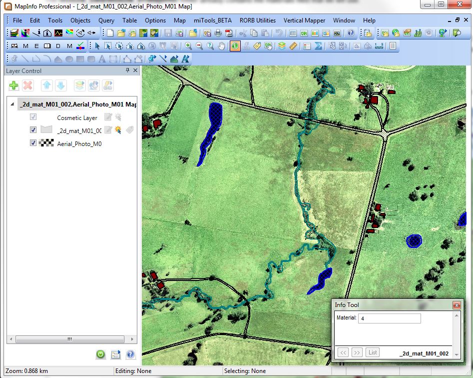
| 11:36, 6 September 2013 | Tute M01 MI Materials 02.JPG (file) |  |
210 KB | Tute Mo1: Materials layer in MapInfo. |
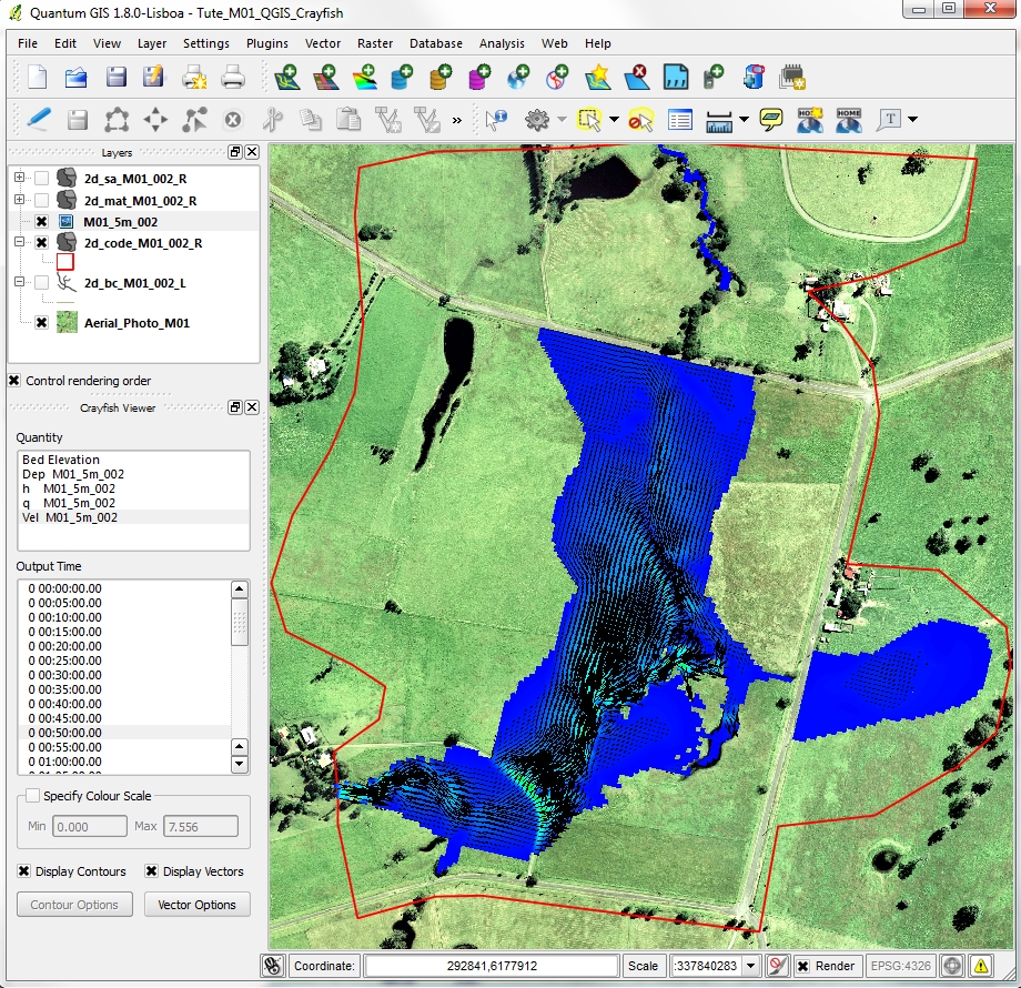
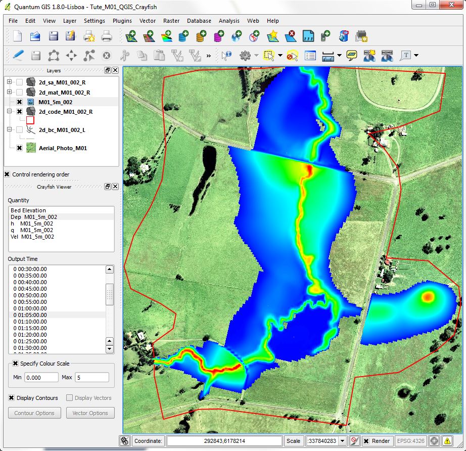
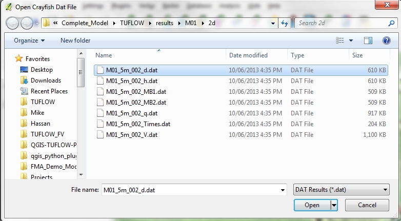
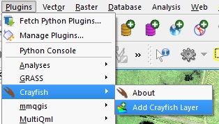
| 12:58, 5 September 2013 | QGIS Crayfish 05.jpg (file) |  |
87 KB | Tute M01 Crayfish 05 |
| 12:58, 5 September 2013 | QGIS Crayfish 04.jpg (file) |  |
873 KB | Tute M01 Crayfish 04 |
| 12:57, 5 September 2013 | QGIS Crayfish 03.jpg (file) |  |
240 KB | Tute M01 Crayfish 03 |
| 12:57, 5 September 2013 | QGIS Crayfish 02.jpg (file) |  |
186 KB | Tute M01 Crayfish 02 |
| 12:56, 5 September 2013 | QGIS Crayfish 01.jpg (file) |  |
57 KB | Tute M01 Crayfish 01 |
| 11:59, 5 September 2013 | Error 0104 windows csv.JPG (file) | 10 KB | Error 0104 Windows format | |
| 11:58, 5 September 2013 | Error 0104 Macintosh csv.JPG (file) | 11 KB | Error 0104 Mac format | |
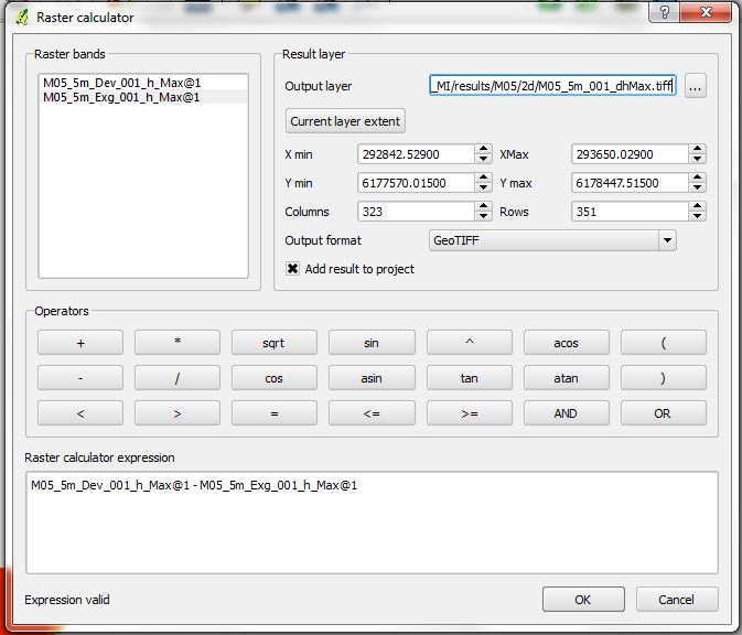
| 16:58, 12 August 2013 | Tute M05 QGIS raster calculator.jpg (file) |  |
68 KB | Tute M05 GIS raster calculator |
| 16:50, 12 August 2013 | Tute M05 QGIS afflux.jpg (file) |  |
129 KB | Tute M05: QGIS flood afflux |
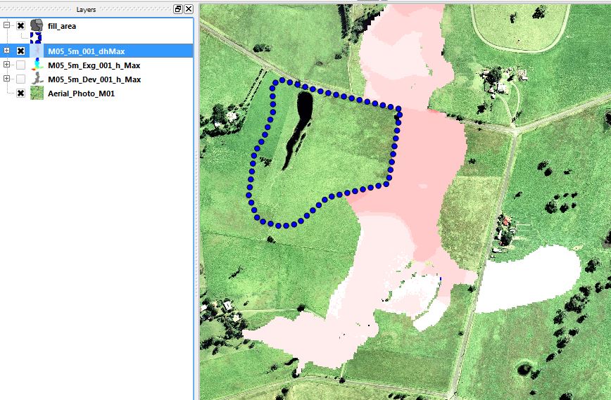
| 16:10, 12 August 2013 | Tute M05 QGIS result grids.jpg (file) |  |
119 KB | Tute M05: QGIS output grids. |
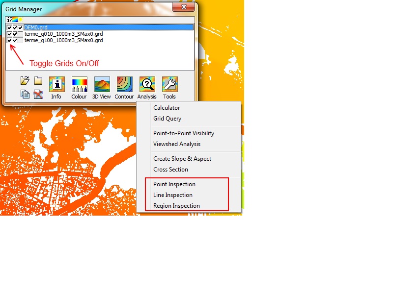
| 12:19, 2 August 2013 | VM Export to asc2.JPG (file) |  |
36 KB | VM export grid to ESRII .asc format for input to TUFLOW |
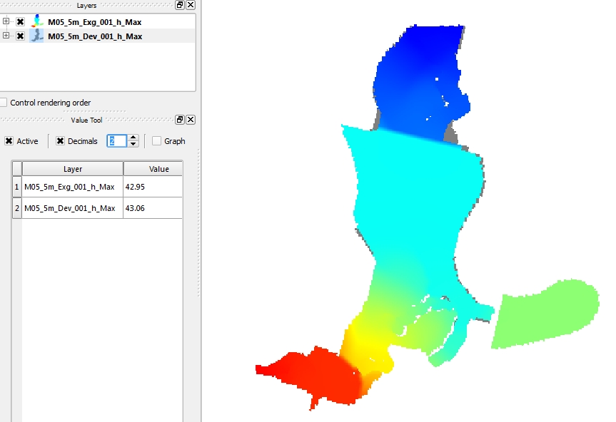
| 11:55, 2 August 2013 | VM Tip grid inspection1.jpg (file) |  |
117 KB | VM Inspecting a grid |
| 17:38, 31 July 2013 | Qgis editing attributes.jpg (file) |  |
27 KB | QGIS entering attribute data |
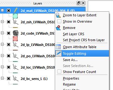
| 17:25, 31 July 2013 | Qgis toggle editing2.jpg (file) |  |
25 KB | QGIS toggle editing from layer control |
| 17:22, 31 July 2013 | Qgis toggle editing.jpg (file) | 55 KB | QGIS toggle editing button | |
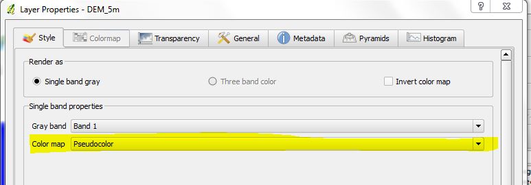
| 16:21, 31 July 2013 | QGIS raster display2.JPG (file) |  |
69 KB | QGIS raster display 2 |
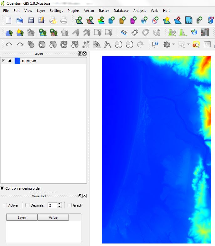
| 16:21, 31 July 2013 | QGIS raster display1.JPG (file) |  |
37 KB | QGIS raster display 1 |
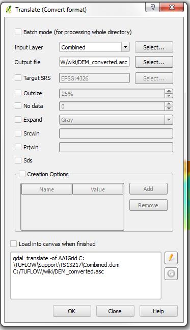
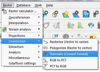
| 09:07, 15 July 2013 | Qgis convert raster04.jpg (file) |  |
41 KB | QGIS Tips: convert raster format 04 |
| 09:07, 15 July 2013 | Qgis convert raster03.jpg (file) |  |
24 KB | QGIS Tips: convert raster format 03 |
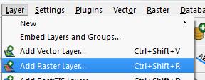
| 09:06, 15 July 2013 | Qgis convert raster02.jpg (file) |  |
23 KB | QGIS Tips: convert raster format 02 |
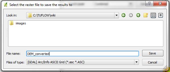
| 09:06, 15 July 2013 | Qgis convert raster01.jpg (file) |  |
10 KB | QGIS Tips: convert raster format 01 |