Search results
Jump to navigation
Jump to search
Page title matches
File:SMS11 1 Results.jpg (1,918 × 1,076 (438 KB)) - 09:02, 24 January 2013
File:Plot 1 setup.png (640 × 480 (7 KB)) - 02:49, 7 April 2022
File:Figures 1 2.jpg (1,010 × 512 (41 KB)) - 21:14, 29 January 2024
File:SMS11 1 Results DataTree.JPG (239 × 412 (31 KB)) - 08:26, 24 January 2013
File:Fig 1 GA Model.png (429 × 535 (14 KB)) - 21:49, 1 June 2020
File:Error 0142(1).jpg Error_0142(1)(520 × 344 (34 KB)) - 01:54, 7 December 2023
File:TS01 FC04 1 Stable.PNG (1,914 × 1,087 (326 KB)) - 12:38, 2 January 2024
File:SMS11 1 M01 Visualization.JPG (1,160 × 1,031 (279 KB)) - 08:10, 24 January 2013
File:Plotting Legend Custom Position 1 1.PNG (775 × 338 (23 KB)) - 03:37, 16 April 2021


.jpg)


Page text matches
File:Tute M01 VM Depth Vel at 1hr.png ...ertical Mapper TUFLOW tutorial model, module 1, depth and velocity at time 1 hour.(1,096 × 708 (605 KB)) - 09:46, 17 August 2011File:Error 0142(1).jpg Error_0142(1)(520 × 344 (34 KB)) - 01:54, 7 December 2023
File:Setting Runner 1.jpg Setting Runner 1(697 × 560 (41 KB)) - 18:32, 19 April 2024
File:Tute M01 TUFLOW DOS Window02.png Used in tutorial module 1(1,013 × 410 (55 KB)) - 16:31, 2 March 2011
File:Tute M01 MI Model Domain Check.png Used in tutorial module 1(640 × 840 (393 KB)) - 16:31, 2 March 2011
File:Running the tool 1.jpg Running the tool 1(804 × 612 (58 KB)) - 17:58, 19 April 2024
File:QGIS raster display1.JPG QGIS raster display 1(773 × 270 (37 KB)) - 16:21, 31 July 2013
File:Arc Label Adv01.jpg ArcTips - Labelling advanced 1.(664 × 518 (150 KB)) - 03:56, 17 October 2012
File:Arc Create Projection1.jpg ArcTips - Create Projection 1.(471 × 843 (241 KB)) - 09:15, 17 October 2012
File:Tute M01 TUFLOW Empties Created.png Used in Tutorial Module 1(249 × 126 (5 KB)) - 13:16, 2 March 2011
File:Tute M01 ActiveArea MI Map Boundary.png Used in tutorial module 1.(638 × 777 (477 KB)) - 11:07, 3 March 2011
File:Tute M01 Arc zpt check 01.png Arc: Create DEM from points 1.(659 × 499 (29 KB)) - 11:10, 26 January 2012
File:NotepadPlusPlus OpenFile1.png Notepad++ Open File Relative 1(771 × 358 (45 KB)) - 13:53, 13 February 2012
File:Tute M01 Res Grids Saga1.png SAGA: Import Grid Step 1(216 × 224 (7 KB)) - 09:18, 15 September 2011
File:Tute M01 QGIS 2d code1.png Tute M01: QGIS step 1(312 × 392 (17 KB)) - 13:04, 28 December 2011
File:Arc Label Basic1.jpg ArcTips - Labelling, basic step 1.(439 × 511 (113 KB)) - 03:33, 17 October 2012
File:QGIS relief shading 01.png QGIS Relief Shading, step 1.(658 × 526 (119 KB)) - 10:35, 3 January 2012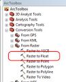
File:Arc raster to flt1.jpg Arc Raster to Float 1(228 × 282 (55 KB)) - 14:57, 21 March 2014
File:Tute M01 Saga Zpt NullRemoved.png Saga: Module 1 with Null Zpts Removed(960 × 895 (118 KB)) - 14:29, 25 August 2011
File:Tute M01 Inspect Zpts MI Map All Zpts.png Used in tutorial model 1, inspect Zpts.(640 × 840 (163 KB)) - 09:14, 3 March 2011


