Difference between revisions of "Tutorial M06 002 GIS Inputs QGIS"
Jump to navigation
Jump to search
(→Method) |
(→Method) |
||
| Line 18: | Line 18: | ||
<br> | <br> | ||
<li>Open the attribute table of the 2d_rf layer and make the following edits: | <li>Open the attribute table of the 2d_rf layer and make the following edits: | ||
| − | :*Update names to match the names in the ''' | + | :*Update names to match the names in the '''rainfall_stations.csv''' input data (RF_FC04, RF_FC05, RF_FC06, RF_FC07) |
:*f1: 1 | :*f1: 1 | ||
:*f2: 1 <br> | :*f2: 1 <br> | ||
Revision as of 16:47, 7 April 2023
Introduction
QGIS is used to create, import and view input data.
Method
Create a 2d_rf layer with digitised polygons based on the input rainfall hyetographs:
- Click on the ‘Import Empty File’ tool from the TUFLOW Plugin toolbar.
- Select '2d_rf' from the Empty Type list.
- In the Run ID box write: 'M06_polygons_002'.
- Tick the 'Regions' Geometry Type and hit 'OK'. The 2d_rf appears in the QGIS Layers panel.
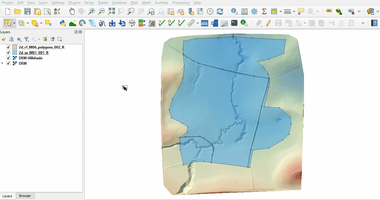
The same catchment breakup is used as the 2d_sa layer:
- Navigate to the Module_06\TUFLOW\model\gis folder and open the 2d_sa_M01_001_R.shp layer in QGIS.
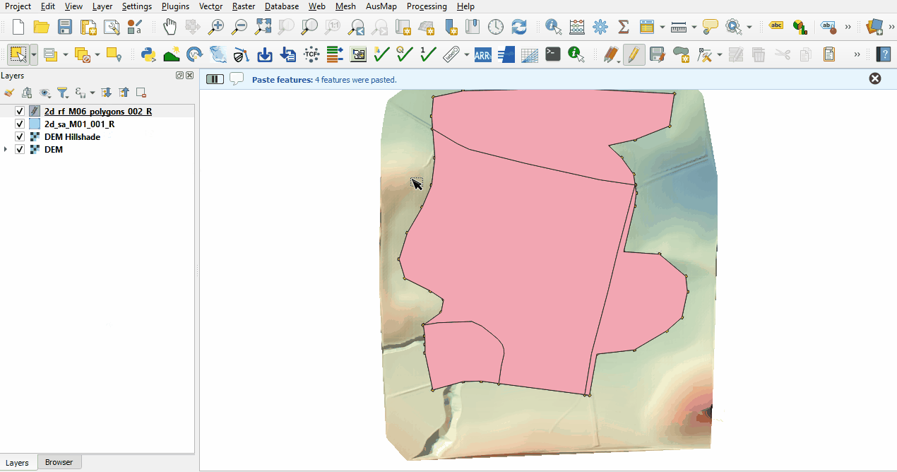
- Copy and paste the polygons from the 2d_sa layer into the 2d_rf:
- Open the attribute table of the 2d_rf layer and make the following edits:
- Update names to match the names in the rainfall_stations.csv input data (RF_FC04, RF_FC05, RF_FC06, RF_FC07)
- f1: 1
- f2: 1
- Turn off editing to save the edits.


Conclusion
- Polygons have been digitised based on input rainfall hyetographs.
| Up |
|---|