Check Files 2d vzsh
This GIS check file layer is only written if a variable Z shape object (2d_vzsh) is used in the model. vzsh_zpt_check contains information on the elevation points that may change over time, the elevation change, final elevation as well as the trigger conditions.
Note that if using a variable Z shape, the map output type "zh" can be included in the Map Output Data Type == command to write the elevations over time. For example, the following command would output water levels (h), velocities (v), depths (d) and elevations (zh):
Map Output Data Type == h v d zh
Attributes of vzsh_zpt_check
| Attribute Name | Attribute Description |
|---|---|
| dZ | The change in elevation that will be caused by the variable Z shape. A negative value indicates the elevation will decrease and a positive value indicates the elevation will increase. |
| Final_Z | The final elevation after variable elevation has been triggered. |
| Type | Whether the variable Z shape is applying as a point or side. |
| Period | The number of hours over which the elevation change will occur. |
| When | A text description of when the change will start. For example "Water level at [138;76] exceeds 41.". |
| Reinstate | A text description of when the elevation reinstate option used. "Not Set" if no reinstate occurs. For example: Starting <value>hours afterwards over a period of <value> hours, once only. |
| Time_Intrp | |
| Source | The input GIS file which was used. |
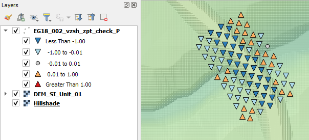
In the image below, the _vzsh_zpt_check has been styled by the dZ attribute (default TUFLOW styling).

| Up |
|---|