FM Tute M02 MI Define Roughness
Jump to navigation
Jump to search
- Copy the contents of the Module_data\Module_02\Materials into the TUFLOW\model\mi folder. This folder contains the following two layers:
- 2d_mat_FMT_M02_DEV_001_R.mid, and
- 2d_mat_FMT_M02_DEV_Buildings_001_R.mid.
- Open both layers in the current view in MapInfo. The 2d_mat_FMT_M02_DEV_00_R layer contains polygons defining grassed areas and roads within the proposed development. The 2d_mat_FMT_M02_DEV_Buildings_001_R layer contains polygons defining the buildings within the proposed development.
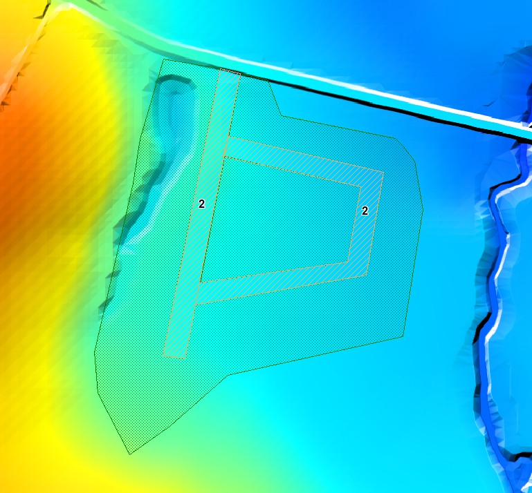
- The materials attribute for a number of polygons representing proposed roads in the 2d_mat_FMT_M02_DEV_001_R.mid layer have not been assigned and will need to be populated. Assign a Material ID of 2 to these polygons as shown in the figure below. Leave the remaining larger polygon with a Material ID of 1.
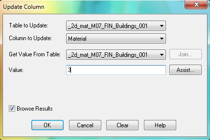
All polygons within the 2d_mat_FMT_M02_DEV_Buildings_001_R layer represent the buildings of the proposed development and will have the same Material ID of 3. Make use of the ‘Update Column’ feature to automatically assign this value to all objects at the same time. Select the dropdown menu Table > Update Column. Select 2d_mat_FMT_M02_DEV_Buildings_001_R as the ‘Table to Update’ and ‘Material’ as the ‘Column to Update’. Type 3 in the Value field. Click OK when done. Viewing the 2d_mat_FMT_M02_DEV_Buildings_001_R layer within a Table Browser should confirm that a value of 3 for the attribute ‘Material’ has been assigned to all objects.
- Open the Materials.csv file within the TUFLOW\model\ folder to observe the Manning’s n values that will be assigned to each Material ID.
- Save and export both 2d_mat_FMT_M02_DEV_001_R and 2d_mat_FMT_M02_DEV_Buildings_001_R layers in MID/MIF format.
Conclusion
Two 2d_mat GIS layers have been created to define land use categories representing the proposed development. Flood Modeller Module 2 Tutorial.
Introduction
This page describes the method for using MapInfo to create the GIS based material types (land use areas) for the proposed development. Once these layers have been setup, surface roughness or bed-resistance values (e.g. Manning’s n) are assigned to each of these land use areas via the materials.csv file located in the model folder.

