M02 QGIS Error 2050 Archive
Jump to navigation
Jump to search
- To locate the error load the M02_5m_001_messages_P.shp file from the TUFLOW\runs\log\ folder.
- To zoom to the location, right click on the layer in the "Layer Control" and select "Zoom To Layer". The error should be shown as per the image below.
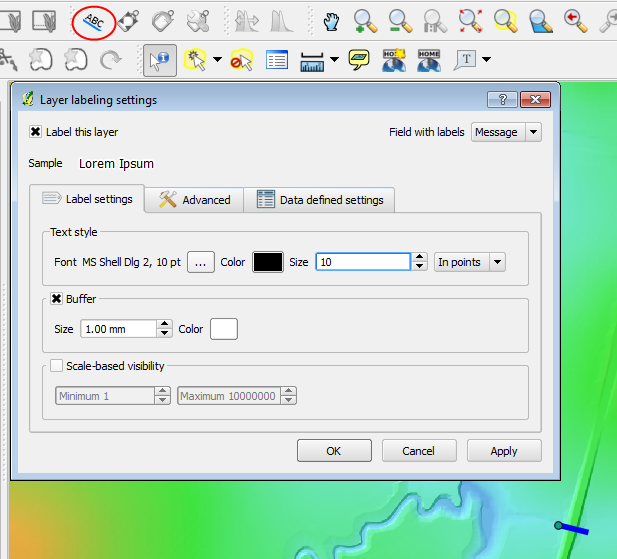
- To make the error easier to see, we will label the error to do this, select the label icon (highlighted in the image below). In the Labelling dialogue:
- Tick the "Label This Layer" check box; and
- Set the "Field with Labels" to "Message".
In the map window the location of the error message should be easy to see.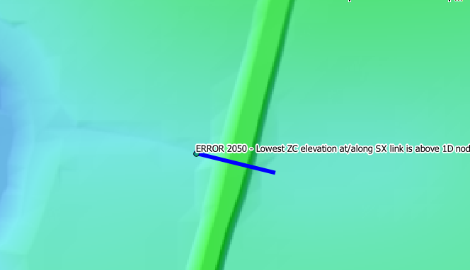
- The message text indicates that the 1D bed has the elevation 32.75, whilst the 2D elevation is 42.75. Review of the DEM shows that the 2D elevations in the area are well above 40metres and indicates that the 1D elevation has been incorrectly provided as 32.75 as opposed to 42.75.
Introduction
In this page we will use the messages layer generated by TUFLOW to locate the cause of an error.
Method


Conclusion
We have located the source of the error message, please return to the module 2 page, where we will address the issue.