QGIS Export Raster to asc
Jump to navigation
Jump to search
Introduction
A large number of different file formats are used for storing raster or DEM data. In this page we will use QGIS to convert a format not recognised by TUFLOW into a format used by TUFLOW. In this example a .dem file format is used. However, a large number of formats are supported in the GDAL raster formats, a list is provided here: GDAL Raster Formats.
Method
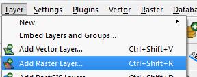
- Open the file you wish to convert by selecting Layer >> Add Raster Layer
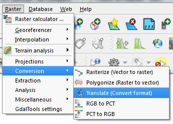
- Open the raster translator by selecting Raster >> Conversions >>Translate
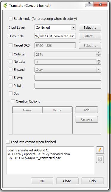
- Set the input layer and in the Output file press the Select Button
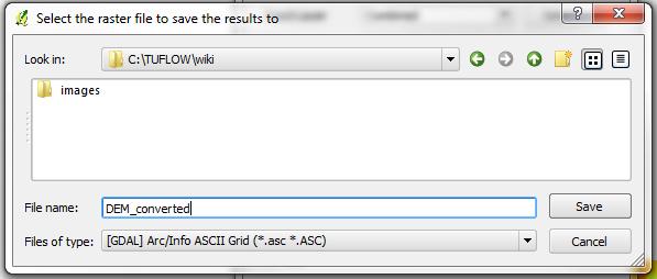
- In the save dialogue, drop the file type down and select Arc/Info ASCII Grid (*.asc *.ASC). Set a filename and path including the .asc extension. Press Save to close the dialogue.
- Press ok to perform the translation.
- The file is now ready for input in TUFLOW, the .tgc command is Read GRID Zpts == <dem.asc> NOTE, QGIS can default to the Golden Surfer type of ascii grid. This grid format does not have square cell sizes and is not currently supported by TUFLOW.


There is more information on this issue in this stack exchange post. To correct this issue, add '-co force_cellsize=true' to the text box underneath the 'load into canvas when finished' button. Add the text after the word 'gdal_translate' Caution, check your results as this may distort your grid
| Up |
|---|