TUFLOW Viewer - Import FV Tide BC NetCDF
Tool Description
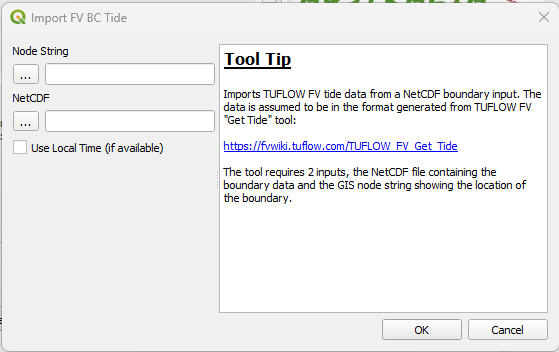
Loads a TUFLOW FV water level curtain boundary. The following files are required for loading:
- NetCDF (.nc) file containing the water level data
- Nodestring GIS file (.shp or .mif) showing the location of the boundary
The option to use 'local time' is also available in the input dialog. Selecting this will use the local time (if it is available) from the NetCDF file. The timezone information will be appended to the result name for the users information.
Note: If 'local time' is not available, the request will be ignored and the default UTC data will be loaded.
The nodestring will be loaded by the tool (the user does not need to manually load this into QGIS) as well as a point layer showing the locations along the nodestring where water levels have been specified.
Note: This tool requires the 'shapely' library to be installed in your QGIS Python environment. Shapely should be installed in most standard QGIS installations (depending on QGIS version), however if QGIS has been installed via OSGeo4W, then it is reliant on the user to have selected 'shapely' as part of that installation process. It is possible to check whether shapely is installed by opening QGIS, opening the Python console, and typing import shapely and pressing return. If there are no errors, then you have shapely installed in your QGIS Python environment.
Example
| Up |
|---|


