Tute Arc M01 Create Projection Archive
Jump to navigation
Jump to search
- Open ArcCatalog and Select Connect to Folder. Navigate to the TUFLOW\model\gis\ folder on your computer and select OK
- In the Catalog window, select this folder connection
- Create a new shapefile by selecting File >> New >> Shapefile...
- Set the name as Projection
- In the Spatial Reference Select Edit
- Choose Select to select a predefined coordinate system
- Select Projected Coordinate Systems >> UTM >> WGS 1984 >> WGS 1984 UTM Zone 60S.prj and click Add. The Spatial Reference Properties should look like the image below:
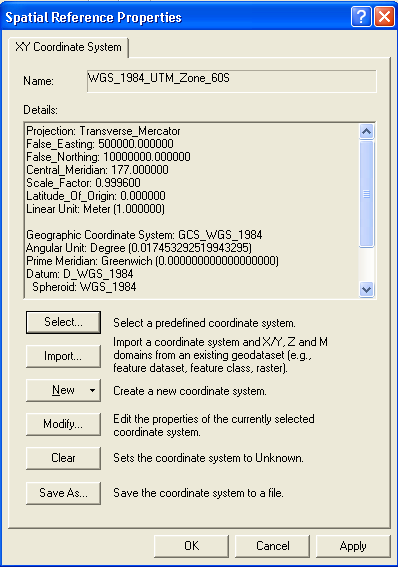
Spatial Reference Properties - At the Spatial Reference Properties select Apply and the OK
- The Create New Shapefile dialogue should now look like the image below. Select Ok to create the new shapefile.
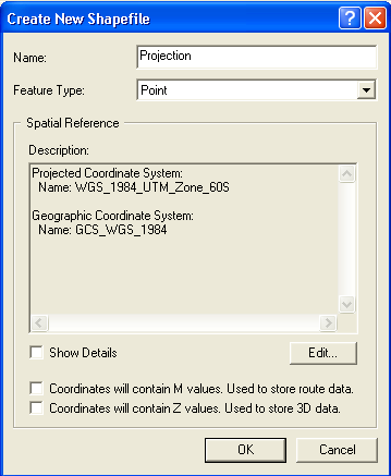
Create New Shapefile named Projection
Introduction
This page describes the process of creating a new shape file in ArcCatalogue. We will define the projection of this shapefile and this will be used to set the GIS coordinate system (projection) of the TUFLOW model.
Method


Conclusion
A new GIS layer has been created. This will be used to define the projection of the TUFLOW model. Please return to the tutorial module page here.