Tute M01 Materials MI Archive
Introduction
This page details the method for using MapInfo to create the GIS based material types (land use areas). Once the GIS layers are setup (in this section), surface roughness or bed-resistance values (e.g. Manning's n) are assigned to each of these land use areas (in the main tutorial module, here).
The Module_Data\Module_01\MapInfo\ folder contains the materials files that we will use.
GIS Data
- Copy the 2d_mat_M01_002 files (note that there are four files to copy when copying the one MapInfo layer, all are required) to the TUFLOW\model\mi\ folder.
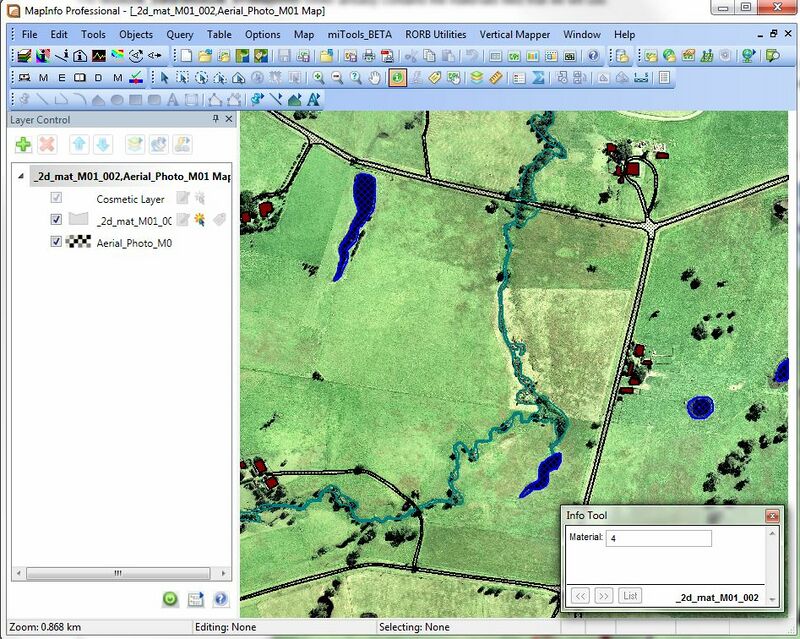
- Open in the current view and turn off all other layers except for the aerial photo and the 2d_mat layer.
NOTE: The material attribute associated with each polygon is an integer number specific to a type of land-use. In the next step we link the material ID (integer) to a roughness coefficient. A table is provided below for reference.
This method of using a "database" to associate hydraulic properties with the land-use will allow us to specify other attributes based on the land-use. For example, when using a direct rainfall on grid approach, rainfall losses can also be set on the land-use layer.
Land Use PropertiesMaterial ID Land Use Manning's n 1 Pasture 0.06 2 Roads 0.022 3 Buildings 3.0 4 Ponds and other water 0.03 10 Vegetated Creek 0.03

Alternatively If you would like to create your own material inputs rather than using the supplied dataset.
- Import the empty (template) file named 2d_mat_empty.mif from TUFLOW\Model\mi\empty\and save this in the TUFLOW\model\mi\ folder as as 2d_mat_M01_002.tab, add this file in the Layer Control, make it editable and digitise your own material polygons ensuring to assign a Material ID to each polygon as shown above.
- Export the 2d_mat_M01_002 table.
TUFLOW Geometry Control (TGC) File Updates
In order to read in the GIS layer created above. Enter the following text into the TGC file:
Set Mat == 1 ! Set every cell to a material ID of 1 (Pasture)
Read GIS Mat == mi\2d_mat_M01_002.MIF
The Set Mat command sets all 2D cells to a Material ID of 1, which is used for pasture. The Read GIS Mat command updates any 2D cells that fall within the polygons in the 2d_mat layer with the Material attribute value of each polygon. As discussed for the cell code values in the previous section, the order of these Mat commands is important.
Conclusion
MapInfo has been used to view (or create) a "2d_mat" layer which defines the spatial extents of the land use categories. Material commands have been added to the TGC. Please return to Tutorial Module 1.