Check Files 1d inverts: Difference between revisions
Jump to navigation
Jump to search
Content deleted Content added
No edit summary |
No edit summary |
||
| Line 15: | Line 15: | ||
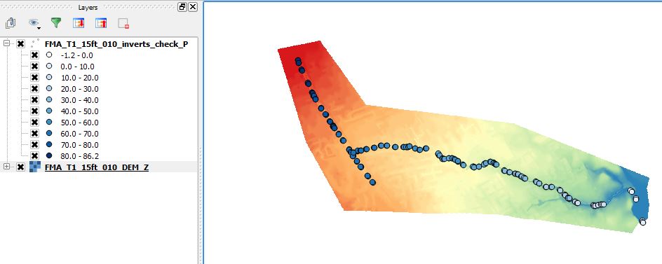
In the image below the 1d_inverts_check is shown for the <u>[[FMA_Challenge_1_(1D-2D_linked) | FMA challenge model 1]]</u>, the layer is styled by the invert elevation.<br> |
In the image below the 1d_inverts_check is shown for the <u>[[FMA_Challenge_1_(1D-2D_linked) | FMA challenge model 1]]</u>, the layer is styled by the invert elevation.<br> |
||
<br> |
|||
[[File:Check Files 1d inverts 01.jpg]] |
[[File:Check Files 1d inverts 01.jpg]] |
||
<br><br> |
|||
{{Tips Navigation |
|||
|uplink=[[TUFLOW_Check_Files | TUFLOW Check Files]] |
|||
}} |
|||
Latest revision as of 13:27, 5 August 2024
The GIS layer contains information of the 1D node and 1D channel inverts. The channel invert does not necessarily have to equal the node invert. For example a 1D channel entering or leaving a storage basin, may be well above the basin invert.
Attributes of inverts_check
| Attribute Name | Attribute Description |
|---|---|
| ID | The ID of the node or channel. |
| Location | "Node" denotes the invert at the 1D node. "U/S" and "D/S" deontes the invert at the upstream and downstream ends of the channel respectively. |
| Invert | The invert in metres or feet. |
In the image below the 1d_inverts_check is shown for the FMA challenge model 1, the layer is styled by the invert elevation.

| Up |
|---|