1D Open Channels: Difference between revisions
Rohan.king (talk | contribs) mNo edit summary |
No edit summary |
||
| (13 intermediate revisions by 4 users not shown) | |||
| Line 1: | Line 1: | ||
<font size = 18>Page Under Construction</font> |
|||
<br> |
|||
<br> |
|||
<br> |
|||
=Introduction= |
=Introduction= |
||
Open waterways (channels) are most commonly modelled as "S" type channels, the S signifies a sloping channel that can handle steep, super-critical flows. Open channels can either be modeled as an inertial or non-inertial channel, the latter removes the Courant stability condition and is useful for stabilizing very short S channels with high velocities.<br> |
Open waterways (channels) are most commonly modelled as "S" type channels, the S signifies a sloping channel that can handle steep, super-critical flows. Open channels can either be modeled as an inertial or non-inertial channel, the latter removes the Courant stability condition and is useful for stabilizing very short S channels with high velocities.<br> |
||
| Line 20: | Line 16: | ||
<font color="blue"><tt>Read GIS Table Links</tt></font> <font color="red"><tt>==</tt></font><tt>..\model\mi\1d_xs_xxxxx.MIF</tt> ! corresponding cross-section polylines <br> |
<font color="blue"><tt>Read GIS Table Links</tt></font> <font color="red"><tt>==</tt></font><tt>..\model\mi\1d_xs_xxxxx.MIF</tt> ! corresponding cross-section polylines <br> |
||
<br> |
<br> |
||
The tutorial model [[ |
The tutorial model [[Tutorial_M11 | here]] runs through the necessary layers and setup for a 1D open channel within a model. |
||
=Error trapping= |
|||
*''under construction'' |
|||
==Circulations== |
==Circulations== |
||
| Line 30: | Line 23: | ||
==1D/2D boundary - spill level== |
==1D/2D boundary - spill level== |
||
Ideally the location of the HX polyline, that represents the 1D/2D boundary, should be situated along the bank of the open channel. This is covered more in |
Ideally the location of the HX polyline, that represents the 1D/2D boundary, should be situated along the bank of the open channel. This is covered more in the <u>[https://docs.tuflow.com/classic-hpc/manual/latest/ TUFLOW Manual]</u>. In situations where the Digital terrain model does not properly define the bank elevation it can be necessary to include ZP points that are snapped to the HX lines that work in the same way as variable z line modifications. Details on how to set up this GIS layer can be found <u>[[Tutorial_M11_001_GIS_Inputs_QGIS_GPKG#2D_Breaklines | here]]</u>. |
||
<font color="blue"><tt>Read GIS Z HX Line</tt></font> <font color="red"><tt>==</tt></font><tt>..\model\mi\2d_bc_xxxxx.MIF</tt> ! Uses HX lines and ZP points from a 2d_bc layer <br> |
<font color="blue"><tt>Read GIS Z HX Line</tt></font> <font color="red"><tt>==</tt></font><tt>..\model\mi\2d_bc_xxxxx.MIF</tt> ! Uses HX lines and ZP points from a 2d_bc layer <br> |
||
<br> |
|||
=Typical check files used= |
=Typical check files used= |
||
| Line 67: | Line 57: | ||
<br><br><br><br><br><br><br><br> |
<br><br><br><br><br><br><br><br> |
||
<br><br><br><br><br><br><br><br> |
<br><br><br><br><br><br><br><br> |
||
<br><br><br><br> |
<br><br><br><br><br><br><br><br> |
||
<br><br><br><br> |
<br><br><br><br><br><br><br> |
||
Any further questions please email TUFLOW support: [mailto:support@tuflow.com support@tuflow.com] |
Any further questions please email TUFLOW support: [mailto:support@tuflow.com?Subject=TUFLOW%201D%20open%20channels%20help support@tuflow.com] |
||
<br><br> |
<br><br> |
||
{{Tips Navigation |
|||
Back to [[TUFLOW_1D_Hydraulic_Structures | 1D Hydraulic Structures]] |
|||
|uplink=[[ TUFLOW 1D Channels and Hydraulic Structures | Back to 1D Channels and Hydraulic Structures]] |
|||
}} |
|||
Latest revision as of 16:00, 18 November 2024
Introduction
Open waterways (channels) are most commonly modelled as "S" type channels, the S signifies a sloping channel that can handle steep, super-critical flows. Open channels can either be modeled as an inertial or non-inertial channel, the latter removes the Courant stability condition and is useful for stabilizing very short S channels with high velocities.
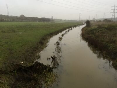
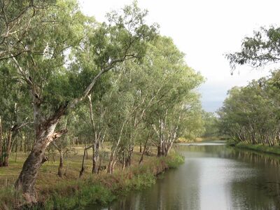
Examples of open channels that could be modelled in 1D


Basic Commands
Within the *.ecf the following commands and files are at a minimum required to a model an open channel:
Read GIS Network ==..\model\mi\1d_nwke_xxxxx.MIF ! network layer containing "S" channel alignments
Read GIS Table Links ==..\model\mi\1d_xs_xxxxx.MIF ! corresponding cross-section polylines
The tutorial model here runs through the necessary layers and setup for a 1D open channel within a model.
Circulations
1D/2D boundary - alignment of cells
1D/2D boundary - spill level
Ideally the location of the HX polyline, that represents the 1D/2D boundary, should be situated along the bank of the open channel. This is covered more in the TUFLOW Manual. In situations where the Digital terrain model does not properly define the bank elevation it can be necessary to include ZP points that are snapped to the HX lines that work in the same way as variable z line modifications. Details on how to set up this GIS layer can be found here.
Read GIS Z HX Line ==..\model\mi\2d_bc_xxxxx.MIF ! Uses HX lines and ZP points from a 2d_bc layer
Typical check files used
The table below highlights some of the commonly used check files when reviewing 1D open channels. The full list of TUFLOW check files can be found here.
Any further questions please email TUFLOW support: support@tuflow.com
| Up |
|---|