12D Model: Difference between revisions
No edit summary |
No edit summary |
||
| Line 16: | Line 16: | ||
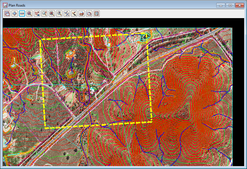
Prior to running this option you need to create a data terrain model (tin) and draw a rectangle indicating the TUFLOW grid extent. |
Prior to running this option you need to create a data terrain model (tin) and draw a rectangle indicating the TUFLOW grid extent. |
||
[[File:GridExtentPolygon.png]] |
|||
<br> |
|||
<br> |
|||
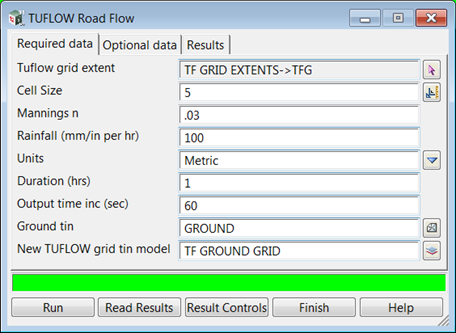
The rectangle is selected using the first field and the tin in entered in the second Ground tin field. The other values are typed entry as desired. |
|||
<br> |
|||
[[File:TUFLOW_Road_Flow.png]] |
|||
Revision as of 10:34, 1 June 2015
Page Under Construction
Introduction
12d model is a complete civil engineering design software including data terrain modelling, road design, sub division, railway, drainage and much more.
The water water resources modules include the 1d HEC RAS interface, 1d pipe systems (culvert and urban networks) with rational and unsteady flow hydrology and the 2d TUFLOW analysis.
12d model integrates TUFLOW with the file creation, editing and result visualisation.
Basics
Getting Started
The Roadflow interface is the quick start method of creating a TUFLOW project. It creates all of the TUFLOW files, launches the TUFLOW engine and reads the results for plan, section and 3d visualisation of results.
Prior to running this option you need to create a data terrain model (tin) and draw a rectangle indicating the TUFLOW grid extent.

The rectangle is selected using the first field and the tin in entered in the second Ground tin field. The other values are typed entry as desired.
