Tutorial M04 Check Files QGIS: Difference between revisions
Jump to navigation
Jump to search
Content deleted Content added
Created page with "= Introduction = QGIS is used to import the check files and review the topographic modification cutting through the embankment, and the layered flow constriction. <br> <br> =..." |
|||
| Line 23: | Line 23: | ||
<li>The lfcsh_uvpt_check file shows the Zpts where the 2d_lfcsh is applied as a thin line. Only the cell sides have the flow constriction applied. The attribute table shows the values specified in the 2d_lfcsh and the final elevation of the invert level after applying the Z shape. <br> |
<li>The lfcsh_uvpt_check file shows the Zpts where the 2d_lfcsh is applied as a thin line. Only the cell sides have the flow constriction applied. The attribute table shows the values specified in the 2d_lfcsh and the final elevation of the invert level after applying the Z shape. <br> |
||
<br> |
<br> |
||
[[File:Animation M04 Check |
[[File:Animation M04 Check 02e.gif]] |
||
</ol> |
</ol> |
||
<br> |
<br> |
||
Revision as of 00:19, 26 August 2022
Introduction
QGIS is used to import the check files and review the topographic modification cutting through the embankment, and the layered flow constriction.
Method
This tutorial introduces:
Review the check files:
- Open the following files from the Module_04\TUFLOW\check folder:
- M04_5m_001_DEM_Z.flt
- M04_5m_001_zsh_zpt_check_P.shp
- M04_5m_001_lfcsh_uvpt_check_P.shp
- Use the 'Apply TUFLOW Styles to Open Layers'.
- The DEM_Z grid shows the final elevations used for the model calculations. Change the styling and inspect the area of the embankment is lowered. See Module 2 for more information on how to review topographic modifications. Note: The DEM_Z appears different to the input DEM as the resolution of the DEM_Z is coarser (2.5m) than the input file (0.5m).
- The zsh_zpt_check file displays the elevation points changed by Z shape topographic update and the TUFLOW styling provides an indication of the elevation difference.
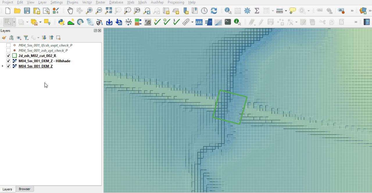
- The lfcsh_uvpt_check file shows the Zpts where the 2d_lfcsh is applied as a thin line. Only the cell sides have the flow constriction applied. The attribute table shows the values specified in the 2d_lfcsh and the final elevation of the invert level after applying the Z shape.


Conclusion
- The DEM_Z and zsh_zpt_check file was used to ensure the cut through was correctly applied to allow flow through the embankment.
- The lfcsh_uvpt_check was viewed showing the form losses and blockages applied to the thin line.
| Up |
|---|