Tutorial M04 Check Files QGIS GPKG: Difference between revisions
Jump to navigation
Jump to search
Content deleted Content added
Created page with "<span style="color:#FF0000"> <font size = 18>Page Under Construction</font> </span> = Introduction = QGIS is used to import the check files and review the topographic modifica..." |
|||
| Line 14: | Line 14: | ||
Review the check files: |
Review the check files: |
||
<ol> |
<ol> |
||
<li> |
<li>Navigate to the '''Module_04\TUFLOW\check''' folder and open the '''M04_5m_001_DEM_Z.tif''' layer into QGIS. |
||
<li>Drag and drop the '''M04_5m_001_Check.gpkg''' from the '''Module_04\TUFLOW\check''' folder into QGIS. |
|||
*'''M04_5m_001_DEM_Z.tif''' |
|||
<li>Open the following layers into QGIS (hold Ctrl to select multiple): |
|||
*'''M04_5m_001_zsh_zpt_check_P.shp''' |
|||
:*'''M02_5m_001_grd_check_R''' |
|||
*'''M04_5m_001_lfcsh_uvpt_check_P.shp''' |
|||
:*'''M02_5m_001_zsh_zpt_check_P''' |
|||
<li>Use the 'Apply TUFLOW Styles to Open Layers'. |
<li>Use the 'Apply TUFLOW Styles to Open Layers'. |
||
<li>Use the 'Apply GPKG Layer Names'. |
|||
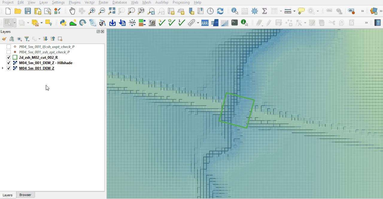
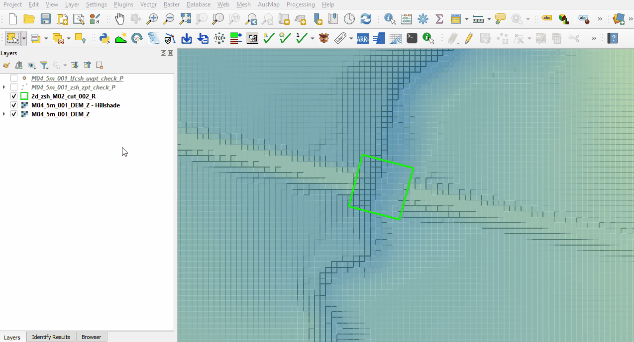
<li>The DEM_Z grid shows the final elevations used for the model calculations. Change the styling and inspect the area of the embankment is lowered. See <u>[[ |
<li>The DEM_Z grid shows the final elevations used for the model calculations. Change the styling and inspect the area of the embankment is lowered. See <u>[[Tutorial_M02_001_Check_Files_QGIS_GPKG | Module 2]]</u> for more information on how to review topographic modifications. Note: The DEM_Z appears different to the input DEM as the resolution of the DEM_Z is coarser (2.5m) than the input file (0.5m).<br> |
||
<li>The zsh_zpt_check file displays the elevation points changed by Z shape topographic update and the TUFLOW styling provides an indication of the elevation difference.<br> |
<li>The zsh_zpt_check file displays the elevation points changed by Z shape topographic update and the TUFLOW styling provides an indication of the elevation difference.<br> |
||
<br> |
<br> |
||
Revision as of 14:44, 8 June 2023
Page Under Construction
Introduction
QGIS is used to import the check files and review the topographic modification cutting through the embankment, and the layered flow constriction.
Method
This tutorial introduces:
Review the check files:
- Navigate to the Module_04\TUFLOW\check folder and open the M04_5m_001_DEM_Z.tif layer into QGIS.
- Drag and drop the M04_5m_001_Check.gpkg from the Module_04\TUFLOW\check folder into QGIS.
- Open the following layers into QGIS (hold Ctrl to select multiple):
- M02_5m_001_grd_check_R
- M02_5m_001_zsh_zpt_check_P
- Use the 'Apply TUFLOW Styles to Open Layers'.
- Use the 'Apply GPKG Layer Names'.
- The DEM_Z grid shows the final elevations used for the model calculations. Change the styling and inspect the area of the embankment is lowered. See Module 2 for more information on how to review topographic modifications. Note: The DEM_Z appears different to the input DEM as the resolution of the DEM_Z is coarser (2.5m) than the input file (0.5m).
- The zsh_zpt_check file displays the elevation points changed by Z shape topographic update and the TUFLOW styling provides an indication of the elevation difference.
- The lfcsh_uvpt_check file shows the Zpts where the 2d_lfcsh is applied as a thin line. Only the cell sides have the flow constriction applied. The attribute table shows the values specified in the 2d_lfcsh and the final elevation of the invert level after applying the Z shape.


Conclusion
- The DEM_Z and zsh_zpt_check file was used to ensure the cut through was correctly applied to allow flow through the embankment.
- The lfcsh_uvpt_check was viewed showing the form losses and blockages applied to the thin line.
| Up |
|---|