QGIS Export Raster to asc
Introduction
A large number of different file formats are used for storing raster or DEM data. In this page we will use QGIS to convert a format not recognised by TUFLOW into a format used by TUFLOW. In this example a .dem file format is used. However, a large number of formats are supported in the GDAL raster formats, a list is provided here: GDAL Raster Formats.
Method
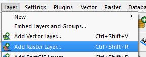
- Open the file you wish to convert by selecting Layer >> Add Raster Layer
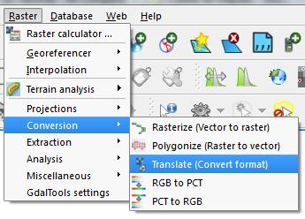
- Open the raster translator by selecting Raster >> Conversions >>Translate
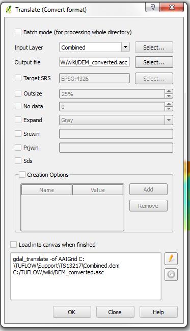
- Set the input layer and in the Output file press the Select Button
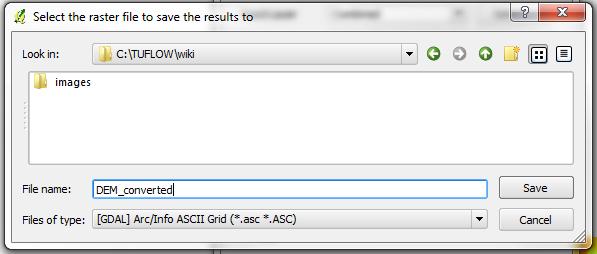
- In the save dialogue, drop the file type down and select Arc/Info ASCII Grid (*.asc *.ASC). Set a filename and path including the .asc extension. Press Save to close the dialogue.
- Press ok to perform the translation.
- The file is now ready for input in TUFLOW, the .tgc command is Read GRID Zpts == <dem.asc>


