Check Files 2d to 2d bc
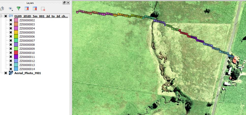
This GIS check file layer contains more information on the 2D/2D boundary links. Boundary cells from both domains are output as region objects. Please refer to the TUFLOW documentation for more information on the 2D 2D linking method.
This layer is output only if a model uses multiple 2D domains.
Attributes of 2d_to_2d_check
| Attribute Name | Attribute Description |
|---|---|
| ZC | The ZC (cell centre) elevation of the 2D/2D boundary cell. |
| Z_2D2D_Line | The bed elevation based on the hidden 1D nodes. |
| Primary_Point | A series of 1D nodes or control points are used along the line to set the water level in both domains. The node ID of the primary node along the 2D 2D link. |
| Secondary_Point | The node ID of the secondary node along the 2D 2D link. |
| Weight_to_P | The weighting to the primary node along the 2D 2D link. |
| Weight_to_S | The weighting to the secondary node along the 2D 2D link. |
| Flags | The boundary flags that have been specified (if any) |
| Domain_Name | The name of the 2D domain the connection applies to. |
| fxob | The oblique boundary x factor. |
| fyob | The oblique boundary y factor. |
| ZC_max | The maximum ZC along the link. |
| Use_ZC_Max | Whether the max ZC elevation is being used to set the ZC for the cell. |
In the image below, the check file has been styled on the Primary_Point attribute.
