|
|
| Line 51: |
Line 51: |
| | <br> | | <br> |
| | <br> | | <br> |
| − | {| align="center" class="wikitable" width="75%"
| |
| − |
| |
| − | ! style="background-color:#005581; font-weight:bold; color:white;"| Filename prefix / suffix
| |
| − | ! style="background-color:#005581; font-weight:bold; color:white;" width=75%| Brief Description
| |
| − | |-
| |
| − | | [[Check_Files_1d_hydroprop | _hydroprop_check.mif<br>_hydroprop_check_L.shp]]|| Contains the hydraulic properties at the top of the hydraulic properties tables as attributes of the 1D channels. Other information such as the primary Manning’s n is also provided. Very useful for carrying out quality control checks on the 1D channels.
| |
| − | |-
| |
| − | | [[Check_Files_1d_inverts | _inverts_check.mif<br>_inverts_check_P.shp]]|| Contains the inverts of the 1D nodes and at the ends of the 1D channels. Very useful for checking for smooth transitions from one channel to another and with the nodes.
| |
| − | |-
| |
| − | | [[Check_Files_1d_IWL | _iwl_check.mif<br>_iwl_check_P.shp]]|| GIS .mif/.mid or .shp files of the initial water levels at the 1D model nodes.
| |
| − | |-
| |
| − | | [[Check_Files_1d_nwk_C | _nwk_C_check.mif<br>_nwk_C_check_L.shp]]|| GIS .mif/.mid or .shp files of the final 1D model network. This check layer contains the channels of the 1D domain only. The _nwk_N_check layer contains the nodes.<br>
| |
| − | The layers lines are coloured based on the channel type (available for the .mid/.mif format only).<br>
| |
| − | Any generated pit channels are shown as a small channel flowing from north to south into the pit node. The upstream pit channel node that is generated is also shown. The length of the pit channel is controlled by <font color="blue"><tt>Pit Channel Offset </tt></font> <font color="red"><tt>==</tt></font> command.
| |
| − | |-
| |
| − | | [[Check_Files_1d_nwk_N | _nwk_N_check.mif<br>_nwk_N_check_P.shp]]|| GIS .mif/.mid or .shp files of the final 1D model network. This check layer contains the nodes of the 1D domain only. The _nwk_C_check layer contains the channels.<br>
| |
| − | The node symbology is displayed as a red circle for nodes connected to two or more channels, a larger magenta circle for nodes connected to one channel and a large yellow square for nodes not connected to a channel (available for the .mid/.mif format only). '''This is very useful for checking for channel ends or nodes that are not snapped.'''<br>
| |
| − | The top and bottom elevations of the NA table at nodes is now shown using the Upstream_Invert and Downstream_Invert attributes.
| |
| − | |-
| |
| − | | [[Check_Files_1d_WLLo | _WLLo_check.mif<br>_WLLo_check_L.shp<br>_xWLLo_check.mif<br>_xWLLo_check_L.shp]]|| GIS layer of all the WLL objects read. The attributes provide information on which nodes that area associated with, etc. <br>
| |
| − | The _WLLo_check layers are written for ESTRY 1D domains, whereas the _xWLLo_check layers are written for external 1D domains, such as Flood Modeller or XP-SWMM.
| |
| − | |-
| |
| − | | [[Check_Files_1d_WLLp | _WLLp_check.mif<br>_WLLp_check_P.shp<br>_xWLLp_check.mif<br>_xWLLp_check_P.shp]]|| GIS layer of where the points were generated along the WLLs. These points can then be used for <font color="blue"><tt>Read GIS WLL Points</tt></font> <font color="red"><tt>==</tt></font> command.<br>
| |
| − | The _WLLp_check layers are written for ESTRY 1D domains, whereas the _xWLLp_check layers are written for external 1D domains, such as Flood Modeller or XP-SWMM.
| |
| − | |-
| |
| − | | [[Check_Files_1d_xsl | _xsl_check.mif<br>_xsl_check_L.shp]]|| GIS layer containing tabular data as read from 1d_xs input layers. Contains the XS ID and other useful information on the cross-section properties, etc. Refer also to [[Check_Files_1d_ta_tables | _ta_tables_check.csv]].
| |
| − | |-
| |
| − | | [[Check_Files_1d_x1d_chans | _x1d_chans_check.mif<br>_x1d_chans_check_L.shp]]|| GIS layer containing the location of 1D channels from an external 1D domain.
| |
| − | |-
| |
| − | | [[Check_Files_1d_x1d_nodes | _x1d_nodes_check.mif<br>_x1d_nodes_check_P.shp]]|| GIS layer containing the location of 1D nodes from an external 1D domain.
| |
| − | |}
| |
| − |
| |
| − |
| |
| − |
| |
| | <br> | | <br> |
| | <br> | | <br> |
| | Any further questions please email TUFLOW support: [mailto:support@tuflow.com support@tuflow.com] | | Any further questions please email TUFLOW support: [mailto:support@tuflow.com support@tuflow.com] |
Page Under Construction
Introduction
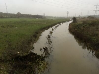
Open waterways (channels) are most commonly modelled as "S" type channels, the S signifies a sloping channel that can handle steep, super-critical flows. Open channels can either be modeled as an inertial or non-inertial channel, the latter removes the Courant stability condition and is useful for stabilizing very short S channels with high velocities.
Example of an open channel that could be modelled in 1D
Basic Commands
Within the *.ecf the following commands and files are at a minimum required to a model an open channel:
Read GIS Network ==..\model\mi\1d_nwke_xxxxx.MIF ! network layer containing "S" channel alignments
Read GIS Table Links ==..\model\mi\1d_xs_xxxxx.MIF ! corresponding cross-section polylines
The tutorial model here runs through the necessary layers and setup for a 1D open channel within a model.
Error trapping
Typical check files used
The table below highlights some of the commonly used check files when reviewing 1D open channels. The full list of TUFLOW check files can be found here.
Any further questions please email TUFLOW support: support@tuflow.com
