Check Files 1d bc check
Jump to navigation
Jump to search
This GIS check file contains the location of any 1D boundaries. These are point objects located at the 1D node locations.
The values for the 1D tabular boundary data (e.g. time-series) can be found in the _1d_bc_tables_check.csv file.
Attributes of 1d_bc_check
| Attribute Name | Attribute Description |
|---|---|
| Type | The type of boundary being applied. Refer to the TUFLOW Manual for a full list of available 1D boundary types. |
| Flags | Any boundary flags. Refer to the TUFLOW Manual for a list of available flags for 1D boundary types. For example the boundary type "S" fits a cubic spline through the data. |
| Name | The name of the boundary condition as it appears in the BC Database. |
| Description | A description of the boundary database used. |
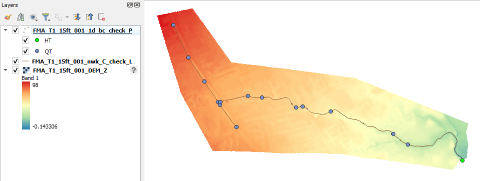
In the image below the 1d_bc_check is shown for the FMA challenge model 1, along with the _1d_nwk_C check file. The 1d_bc_check layer is styled by the boundary type. A number of QT (flow-time) boundaries and a single HT (water level-time) boundary are present in the model.

| Up |
|---|