QGIS SWMM Outfalls Fix Multiply Connected Links
Introduction
This tool creates a conduit extension to resolve the SWMM error with multiple links connected to the same outfall node, a common issue when converting ESTRY models for use in TUFLOW-SWMM.
For each multiply connected outfall, this tool generates a new conduit channel and a corresponding junction node. The new junction node is positioned where the initial outfall node was multiply connected. The new conduit channel is then connected to this junction node, and the outfall node is relocated to the outlet of the new channel. The elevation of the outfall node is adjusted according to the input parameters. The newly created extension channel is always an open rectangular channel with the provided attributes.
This tool takes the existing GeoPackage file (with the multiply connected links) and creates a duplicate. The new GeoPackage is then updated with the channel extension(s).
Note: The generated channels may need to be modified to match the real world geometry at the location.
Usage
This tool, Outfalls - Fix Multiply Connected Links, can be found in the QGIS processing toolbox panel under TUFLOW >> SWMM. To open the Processing Toolbox panel, navigate to 'Processing' in the menubar and select 'Toolbox'.

Parameters
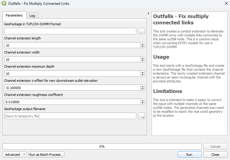
- GeoPackage in TUFLOW-SWMM Format: The input GeoPackage file with multiply connected links.
- Channel extension length: The length of the new conduit channel(s). Minimum value is 0.001.
- Channel extension width: The width of the new conduit channel(s). Minimum value is 0.001.
- Channel extension maximum depth: The depth of the new conduit channel(s). Minimum value is 0.001.
- Channel extension z-offset for new downstream outlet elevation: The difference between the elevation of the upstream node and downstream node. This difference is used to determine the elevation of the new downstream outlet.
- Channel extension roughness coefficient: The Manning's n value for the new conduit channel(s).
- GeoPackage output filename: Determines the location and filename of the output GeoPackage.
Example
| Up |
|---|
