Tutorial M05 Check Files QGIS: Difference between revisions
Jump to navigation
Jump to search
Content deleted Content added
| Line 20: | Line 20: | ||
<li>Use the 'Apply TUFLOW Styles to Open Layers'. |
<li>Use the 'Apply TUFLOW Styles to Open Layers'. |
||
<li>The |
<li>The '''grd_check_R''' is the 2D grid defined by the 2d_code layer and contains a region object for each cell. It is useful to understand how the model is orientated, the cell size in relation to the hydraulic features and where certain calculations occur in the model. In this tutorial, the grid is orientated to align with the downstream road. |
||
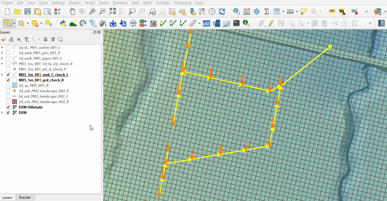
<li>The nwk_C_check file shows all attributes applied to the network elements. Some fields should be inspected as they have changes from the input 1d_nwk_M05_pipes layer: |
<li>The '''nwk_C_check''' file shows all attributes applied to the network elements. Some fields should be inspected as they have changes from the input '''1d_nwk_M05_pipes''' layer: |
||
:*Len_or_ANA: contains the length used by TUFLOW (determined by the digitised line). |
:*Len_or_ANA: contains the length used by TUFLOW (determined by the digitised line). |
||
:*US_Invert: set to the DS_Invert value of the pit snapped to the upstream end. |
:*US_Invert: set to the DS_Invert value of the pit snapped to the upstream end. |
||
| Line 28: | Line 28: | ||
For example, for Pipe 5: |
For example, for Pipe 5: |
||
:*Len_or_ANA: 36.52m based on the digitised line length. |
:*Len_or_ANA: 36.52m based on the digitised line length. |
||
:*US_Invert: set as the DS_Invert of Pit 16 as specified in the 1d_nwk_M05_pits layer. |
:*US_Invert: set as the DS_Invert of Pit 16 as specified in the '''1d_nwk_M05_pits''' layer. |
||
:*DS_Invert: set as the DS_Invert of Pit 15 as specified in the 1d_nwk_M05_pits layer. |
:*DS_Invert: set as the DS_Invert of Pit 15 as specified in the '''1d_nwk_M05_pits''' layer. |
||
:*pSlope: value of 0.5 (US_Invert - DS_Invert / length). |
:*pSlope: value of 0.5 (US_Invert - DS_Invert / length). |
||
<br> |
<br> |
||
[[File:Animation M05 Check 01c.gif]]<br><br> |
[[File:Animation M05 Check 01c.gif]]<br><br> |
||
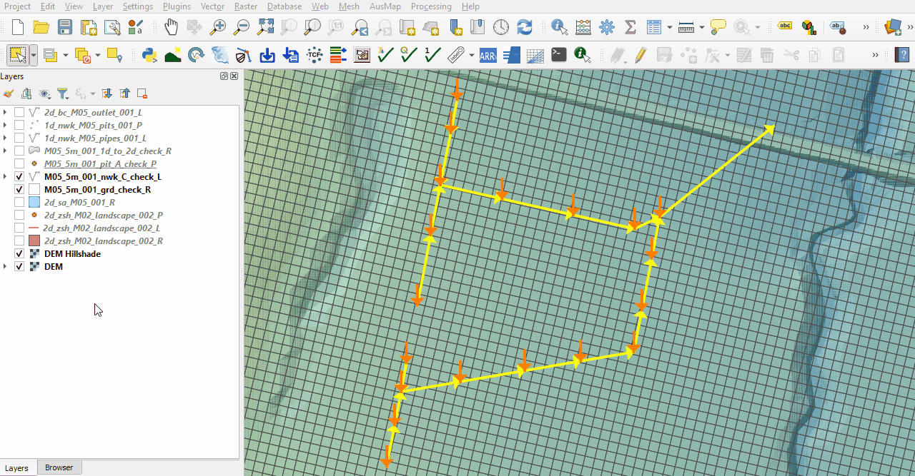
<li>The pit_A_check file shows the pit locations and the attributes applied from the 1d_nwk pits file.<br> |
<li>The '''pit_A_check''' file shows the pit locations and the attributes applied from the 1d_nwk pits file.<br> |
||
<br> |
<br> |
||
[[File:Animation M05 Check 02d.gif]]<br><br> |
[[File:Animation M05 Check 02d.gif]]<br><br> |
||
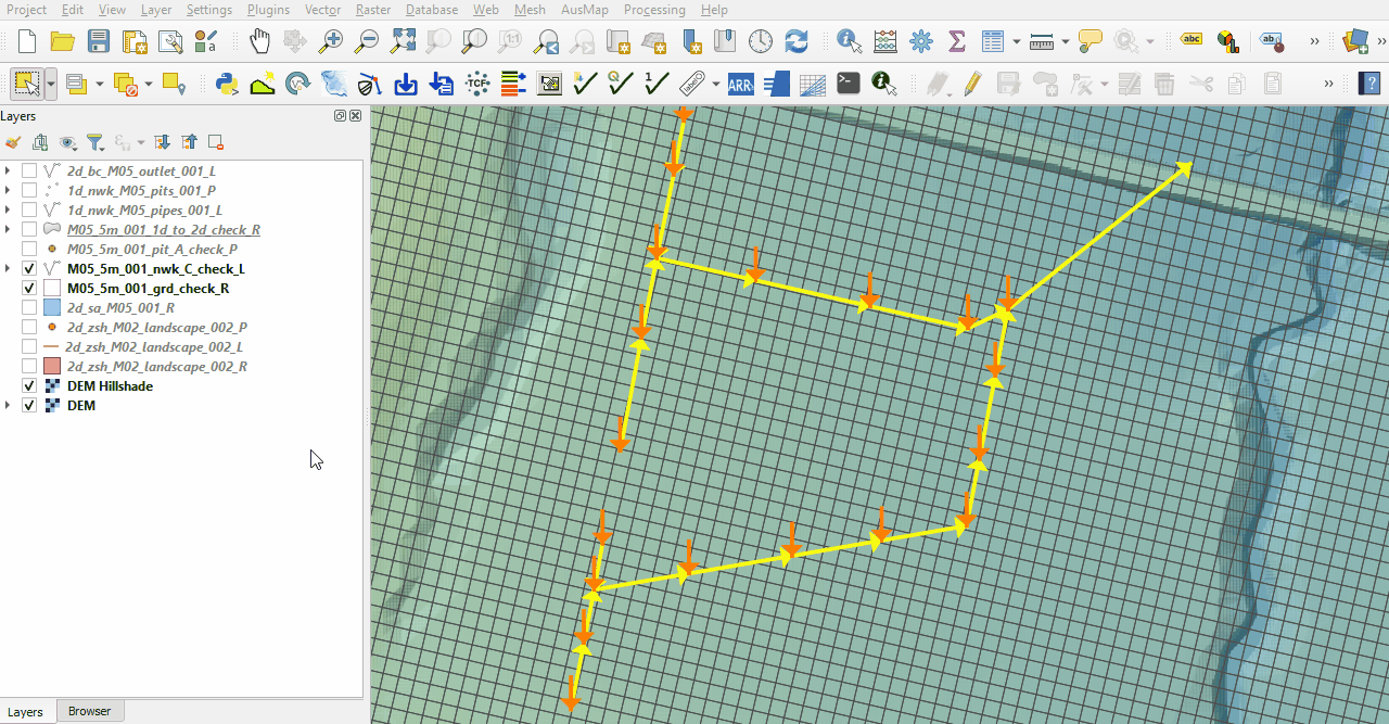
<li>The 1d_to_2d_check file shows the cells selected by the 1d_nwk pits, a single cell per pit, and the cells selected by the outlet of the pipe network (SX line). This is where the water enters the 2D domain from the 1D network. <br> |
<li>The '''1d_to_2d_check''' file shows the cells selected by the 1d_nwk pits, a single cell per pit, and the cells selected by the outlet of the pipe network (SX line). This is where the water enters the 2D domain from the 1D network. <br> |
||
<br> |
<br> |
||
[[File:Animation M05 Check 03c.gif]]<br><br> |
[[File:Animation M05 Check 03c.gif]]<br><br> |
||
Revision as of 12:07, 14 June 2023
Introduction
QGIS is used to import the check files and review the pipes and pits network connected to the 2D domain.
Method
This tutorial introduces:
Review the check files:
- Open the following files from the Module_05\TUFLOW\check folder:
- M05_5m_001_grd_check_R.shp
- M05_5m_001_nwk_C_check_L.shp
- M05_5m_001_pit_A_check_P.shp
- M05_5m_001_1d_to_2d_check_R.shp
- Use the 'Apply TUFLOW Styles to Open Layers'.
- The grd_check_R is the 2D grid defined by the 2d_code layer and contains a region object for each cell. It is useful to understand how the model is orientated, the cell size in relation to the hydraulic features and where certain calculations occur in the model. In this tutorial, the grid is orientated to align with the downstream road.
- The nwk_C_check file shows all attributes applied to the network elements. Some fields should be inspected as they have changes from the input 1d_nwk_M05_pipes layer:
- Len_or_ANA: contains the length used by TUFLOW (determined by the digitised line).
- US_Invert: set to the DS_Invert value of the pit snapped to the upstream end.
- DS_Invert: set to the DS_Invert value of the pit snapped to the downstream end.
- pSlope: the slope of the 1D element.
- Len_or_ANA: 36.52m based on the digitised line length.
- US_Invert: set as the DS_Invert of Pit 16 as specified in the 1d_nwk_M05_pits layer.
- DS_Invert: set as the DS_Invert of Pit 15 as specified in the 1d_nwk_M05_pits layer.
- pSlope: value of 0.5 (US_Invert - DS_Invert / length).
- The pit_A_check file shows the pit locations and the attributes applied from the 1d_nwk pits file.
- The 1d_to_2d_check file shows the cells selected by the 1d_nwk pits, a single cell per pit, and the cells selected by the outlet of the pipe network (SX line). This is where the water enters the 2D domain from the 1D network.


Conclusion
- The grd_check file was imported to help understand the 1D/2D links location.
- The nwk_C_check file was used to inspect the pipes attributes.
- The pit_A_check file was used to ensure correct data were applied for the pits.
- The 1d_to_2d_check file was used to assess the 1D/2D links at pit locations and the outlet of the pipe network to the 2D domain.
| Up |
|---|