Tutorial M10 002 Check Files QGIS GPKG: Difference between revisions
Jump to navigation
Jump to search
Content deleted Content added
Created page with "<span style="color:#FF0000"> <font size = 18>Page Under Construction</font> </span> = Introduction = QGIS is used to import the check files and review the dam break.<br> <br>..." |
|||
| Line 12: | Line 12: | ||
Review the check files: <br> |
Review the check files: <br> |
||
<ol> |
<ol> |
||
<li> |
<li>Drag and drop the '''M10_5m_002_Check.gpkg''' from the '''Module_10\TUFLOW\check''' folder into QGIS. |
||
<li>Open the following layer into QGIS: |
|||
:*'''M10_5m_002_vzsh_zpt_check_P |
:*'''M10_5m_002_vzsh_zpt_check_P''' |
||
<li>Use the 'Apply TUFLOW Styles to Open Layers'. |
<li>Use the 'Apply TUFLOW Styles to Open Layers'. |
||
<li>Use the 'Apply GPKG Layer Names'. |
|||
<li>The vzsh_zpt_check file contains information on the elevation points that change over time, elevation change, final elevation and trigger conditions.<br> |
<li>The vzsh_zpt_check file contains information on the elevation points that change over time, elevation change, final elevation and trigger conditions.<br> |
||
Note: [35;70] is a unique identifier of the grid cell that the water level trigger point is contained within. It comes from the the grd_check layer where, in this example, the attribute 'n' is 35 and 'm' is 70 for the cell containing the trigger. <br> |
Note: [35;70] is a unique identifier of the grid cell that the water level trigger point is contained within. It comes from the the grd_check layer where, in this example, the attribute 'n' is 35 and 'm' is 70 for the cell containing the trigger. <br> |
||
Revision as of 10:27, 31 July 2023
Page Under Construction
Introduction
QGIS is used to import the check files and review the dam break.
Method
This tutorial introduces:
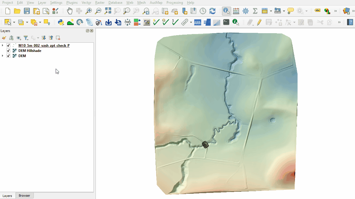
Review the check files:
- Drag and drop the M10_5m_002_Check.gpkg from the Module_10\TUFLOW\check folder into QGIS.
- Open the following layer into QGIS:
- M10_5m_002_vzsh_zpt_check_P
- Use the 'Apply TUFLOW Styles to Open Layers'.
- Use the 'Apply GPKG Layer Names'.
- The vzsh_zpt_check file contains information on the elevation points that change over time, elevation change, final elevation and trigger conditions.
Note: [35;70] is a unique identifier of the grid cell that the water level trigger point is contained within. It comes from the the grd_check layer where, in this example, the attribute 'n' is 35 and 'm' is 70 for the cell containing the trigger.

Conclusion
- The topographic modifications representing the dam break were inspected.
| Up |
|---|