QGIS SWMM Convert XPSWMM Model From XPX
Introduction
This tool converts XPSWMM Hydrology data for use in TUFLOW-SWMM. Unfortunately, XPSWMM does not write out all required hydrology information when doing a simple export to EPA SWMM 5. Some of the parameters, especially infiltration parameters (such as curve numbers), do not get written correctly. This tool can extract information from GIS data exported from XPSWMM for nodes and subcatchments, manipulate it, and add it to the exported EPA SWMM 5 file data.
To export the EPA SWMM 5 Hydrology:
- Ensure 'Runoff Mode' is selected.
- From the top dropdown menu options, select File > Import/Export Data > Export to EPASWMM 5. This will create a '.inp' file in the folder with the XPSWMM project file. To prevent it from being overwritten, it is recommended to copy this file to a new name.
To export the GIS Subcatchment data (required to align with the hydrology data associated with nodes):
- Right click on the catchments layer (under the nodes layer) and click 'Export to GIS File'. Ensure 'All Objects' is ticked on, then click 'Export'.
- Choose an appropriate filename to write the information to.
To export the Hydrology data associated with the nodes:
- Right click on the nodes layer and choose 'Export to GIS File'.
- Expand the 'Node Data and Results' and then the 'Runoff Node' folder.
- The columns to include vary based on the hydrology and infiltration options being used by XPSWMM and what will be used in the TUFLOW-SWMM model. Find the appropriate data fields and double click to add them to the list.
- Choose an appropriate filename to write the information to. Ensure the export file format is '.mif', then click 'Export'.
Usage
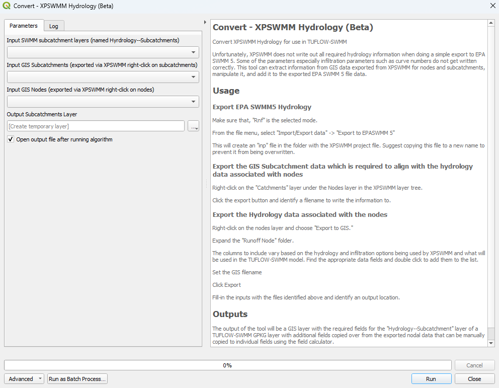
This tool, Convert - XPSWMM Hydrology (beta), can be found in the QGIS processing toolbox panel under TUFLOW >> SWMM. To open the Processing Toolbox panel, navigate to 'Processing' in the menubar and select 'Toolbox'.

Parameters
- Input SWMM subcatchment layers (named Hydrology--Subcatchments):
- Input GIS Subcatchments (exported via XPSWMM right-click on subcatchments): XPSWMM GIS layer containing the subcatchment data.
- Input GIS Nodes (exported via XPSWMM right-click on nodes): XPSWMM GIS layer containing the hydrology data associated with the nodes.
- Output Subcatchments Layer: Determines the location and filename of the output GIS layer. This layer will contain the required fields for the 'Hydrology--Subcatchments' layer of a TUFLOW-SWMM GeoPackage.
Example
| Up |
|---|
