Search results
Jump to navigation
Jump to search
Page title matches

File:Plot 1 setup.png (640 × 480 (7 KB)) - 02:49, 7 April 2022
File:Figures 1 2.jpg (1,010 × 512 (41 KB)) - 21:14, 29 January 2024
File:SMS11 1 Results.jpg (1,918 × 1,076 (438 KB)) - 09:02, 24 January 2013
File:Fig 1 GA Model.png (429 × 535 (14 KB)) - 21:49, 1 June 2020
File:Error 0142(1).jpg Error_0142(1)(520 × 344 (34 KB)) - 01:54, 7 December 2023File:TS01 FC04 1 Stable.PNG (1,914 × 1,087 (326 KB)) - 12:38, 2 January 2024File:SMS11 1 M01 Visualization.JPG (1,160 × 1,031 (279 KB)) - 08:10, 24 January 2013File:SMS11 1 Results DataTree.JPG (239 × 412 (31 KB)) - 08:26, 24 January 2013- In FMA Challenge 1, a fully two-dimensional model with a nested one dimensional model has been The functional FMA Challenge 1 (1D-2D linked) has been developed allowing you to review the model setup, r11 KB (1,798 words) - 13:46, 27 September 2023
File:Plotting Legend Custom Position 1 1.PNG (775 × 338 (23 KB)) - 03:37, 16 April 2021
Page text matches
- |tuflow_message=WARNING 2905 - Code value specified is greater than 1, using 1. |alt_msg=WARNING 2905 - Code value specified is less than -1, using -1.664 bytes (111 words) - 20:09, 23 February 2024

File:Tute M01 VM Depth Vel at 1hr.png ...ertical Mapper TUFLOW tutorial model, module 1, depth and velocity at time 1 hour.(1,096 × 708 (605 KB)) - 09:46, 17 August 2011- |tuflow_message=ERROR 2127 - Free overfall factor must be >0.5 and <=1. |message_desc=Free overfall factor must be >0.5 and <=1. See <u>[http://www.tuflow.com/Downloads/Dynamically%20Linked%202D%20and%20538 bytes (73 words) - 13:35, 7 February 2023
- |tuflow_message=WARNING 2114 - Material ID must be from 1 to 32767. Material below ignored. |message_desc=Material ID must be from 1 to 32767. Material ignored.327 bytes (46 words) - 12:36, 23 December 2022
- ...one nesting polygon found. Will only use one polygon with nesting level of 1. Overriding previously processed polygon. ...d. The last level 1 nesting polygon read by TUFLOW will override any level 1 nesting polygons processed previously.792 bytes (120 words) - 10:01, 3 March 2023
- ...-Newtonian missing expecting AD concentrations for tracer 1 in the range 0-1. ...-Newtonian missing expecting AD concentrations for tracer 1 in the range 0-1. Cell IC: <>.<br>414 bytes (57 words) - 09:11, 3 March 2023
- |tuflow_message=ERROR 3527 - SGS PARTIAL GRID UPDATE NULL FRAC 1 should be smaller than FRAC 2. |alt_msg=ERROR 3527 - Invalid SGS GRID MIN FRAC. This value should be 0 ~ 1.<br>442 bytes (65 words) - 10:28, 3 March 2023
- |tuflow_message=ERROR 2828 - Nesting polygon "a" not completely within level 1 polygon. ...> <font color="red"><tt>==</tt></font> <tt>AUTO</tt> option is used, level 1 polygon in 2d_qnl GIS layer should be within code polygon.690 bytes (110 words) - 10:01, 3 March 2023
- |tuflow_message=ERROR 2827 - No level 1 polyon found. Specify a level 1 nesting polygon or set "<font color="blue"><tt>ORIGIN AND EXTENT</tt></font |message_desc=No level 1 polyon found. Specify a level 1 nesting polygon or set "<font color="blue"><tt>ORIGIN AND EXTENT</tt></font617 bytes (96 words) - 10:01, 3 March 2023
- |tuflow_message=ERROR 2807 - Trying to apply more than 1 level boundary to cell. |alt_msg=WARNING 2807 - Trying to apply more than 1 level boundary to cell.428 bytes (64 words) - 15:49, 24 October 2023
- Your biography must be at least $1 {{PLURAL:$1|word|words}} long.235 bytes (39 words) - 11:05, 27 September 2011
- |tuflow_message=ERROR 3024 - fraction impervious must be in range [0..1]. ...ction of the surface that is impervious to water must be in the range 0 to 1.369 bytes (55 words) - 10:14, 3 March 2023
- |tuflow_message=WARNING 2618 - F1 rainfall factor of 0 set to 1. RF Name: <name> |alt_msg=WARNING 2618 - F2 rainfall factor of 0 set to 1. RF Name: <name>595 bytes (99 words) - 09:43, 3 March 2023
- |tuflow_message=ERROR 2830 - Nesting polygon outside level 1 polygon. ...ompletely within level 1 polygon in 2d_qnl layer or 2d_code layer if level 1 polygon in 2d_qnl layer is not used.<br>1,012 bytes (166 words) - 10:02, 3 March 2023
- |tuflow_message=CHECK 2477 - 12da file has more than 1 tin, without super_tin. |message_desc=12da file has more than 1 tin, without super_tin.320 bytes (48 words) - 09:02, 3 March 2023
- |tuflow_message=ERROR 2576 - Vertical groundwater layer must be between 1 and <>: "<>". |message_desc=Vertical groundwater layer must be between 1 and <>: "<>".337 bytes (44 words) - 09:37, 3 March 2023
- {| align="left" border="1" cellpadding="2" style="border-collapse:collapse; border-color:silver; back | [[Image:go-prev.png]] [[{{{1}}}]] || [[{{{2}}}]] [[Image:go-next.png]]261 bytes (26 words) - 10:19, 20 July 2010
- |tuflow_message=ERROR 2831 - More than 1 parent polygon for polygon with nesting level "<>". |message_desc=More than 1 parent polygon for polygon with nesting level "<>".347 bytes (48 words) - 10:02, 3 March 2023
- Num of Times: 1 Num of Times: 13 KB (340 words) - 00:29, 20 January 2024
- ...message=ERROR 3509 - Invalid SGS ZH SAMPLE RATIO. This value should be 0 ~ 1. |message_desc=Invalid SGS ZH SAMPLE RATIO. This value should be 0 ~ 1.333 bytes (48 words) - 10:24, 3 March 2023
- |tuflow_message=ERROR 2463 - Expecting either 1 or 3 numbers after "<font color="blue"><tt>Control Number Factor</tt></font |message_desc=Expecting either 1 or 3 numbers after "<font color="blue"><tt>Control Number Factor</tt></font433 bytes (60 words) - 08:56, 3 March 2023

File:Error 0142(1).jpg Error_0142(1)(520 × 344 (34 KB)) - 01:54, 7 December 2023- ...t bank (1), mainstream (2) or right bank (3). P values must be entered as 1, 2 or 3. For more details see '''Section 4.6.6.4 Position Flag''' of TUFLO |suggestions=If using P values, these must be either 1, 2 or 3.561 bytes (85 words) - 14:38, 22 December 2022

File:Setting Runner 1.jpg Setting Runner 1(697 × 560 (41 KB)) - 18:32, 19 April 2024- ...nnel <Channel ID> ignoring Number_of attribute value which is greater than 1. ...e or weir channels. For the channel ID specified, a value of greater than 1 has been specified and is being ignored. For culverts this is the number o722 bytes (120 words) - 14:27, 22 December 2022

File:Arc Label Adv01.jpg ArcTips - Labelling advanced 1.(664 × 518 (150 KB)) - 03:56, 17 October 2012
File:Tute M01 TUFLOW Empties Created.png Used in Tutorial Module 1(249 × 126 (5 KB)) - 13:16, 2 March 2011
File:Arc Create Projection1.jpg ArcTips - Create Projection 1.(471 × 843 (241 KB)) - 09:15, 17 October 2012
File:Tute M01 TUFLOW DOS Window02.png Used in tutorial module 1(1,013 × 410 (55 KB)) - 16:31, 2 March 2011
File:Tute M01 ActiveArea MI Map Boundary.png Used in tutorial module 1.(638 × 777 (477 KB)) - 11:07, 3 March 2011
File:Tute M01 MI Model Domain Check.png Used in tutorial module 1(640 × 840 (393 KB)) - 16:31, 2 March 2011File:QGIS raster display1.JPG QGIS raster display 1(773 × 270 (37 KB)) - 16:21, 31 July 2013
File:Running the tool 1.jpg Running the tool 1(804 × 612 (58 KB)) - 17:58, 19 April 2024- |tuflow_message=WARNING 1382 - Manhole Exit Coefficient (Km) is greater than 1. ...as set by the Km attribute in the 1D manhole (1d_mh) layer is greater than 1. This is outside the normal range for this coefficient.413 bytes (62 words) - 10:39, 23 December 2022

File:NotepadPlusPlus OpenFile1.png Notepad++ Open File Relative 1(771 × 358 (45 KB)) - 13:53, 13 February 2012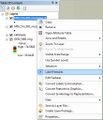
File:Arc Label Basic1.jpg ArcTips - Labelling, basic step 1.(439 × 511 (113 KB)) - 03:33, 17 October 2012
File:Tute M01 QGIS 2d code1.png Tute M01: QGIS step 1(312 × 392 (17 KB)) - 13:04, 28 December 2011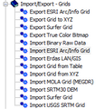
File:Tute M01 Res Grids Saga1.png SAGA: Import Grid Step 1(216 × 224 (7 KB)) - 09:18, 15 September 2011
File:Arc raster to flt1.jpg Arc Raster to Float 1(228 × 282 (55 KB)) - 14:57, 21 March 2014
File:Tute M01 Arc zpt check 01.png Arc: Create DEM from points 1.(659 × 499 (29 KB)) - 11:10, 26 January 2012
File:QGIS relief shading 01.png QGIS Relief Shading, step 1.(658 × 526 (119 KB)) - 10:35, 3 January 2012
File:Tute M01 Inspect Zpts MI VM PointInspect.png Used in tutorial model 1, inspect Zpts.(184 × 319 (7 KB)) - 09:16, 3 March 2011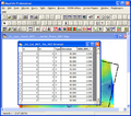
File:Tute M01 Inspect Zpts MI VM All Browse.png Used in tutorial model 1, inspect Zpts.(640 × 566 (76 KB)) - 09:17, 3 March 2011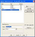
File:Tute M01 Inspect Zpts MI TableStructure.png Used in tutorial model 1, inspect Zpts.(419 × 435 (14 KB)) - 09:18, 3 March 2011
File:Tute M01 Inspect Zpts MI SelectNull.png Used in tutorial model 1, inspect Zpts.(407 × 238 (9 KB)) - 09:18, 3 March 2011
File:Tute M01 Inspect Zpts MI Map Trim Zpts.png Used in tutorial model 1, inspect Zpts.(640 × 830 (161 KB)) - 09:19, 3 March 2011
File:Tute M01 Saga Zpt NullRemoved.png Saga: Module 1 with Null Zpts Removed(960 × 895 (118 KB)) - 14:29, 25 August 2011
File:Tute M01 QGIS 2d sa1.png Tute M01: QGIS, 2d_sa step 1.(891 × 550 (130 KB)) - 17:00, 28 December 2011
File:M04 1d2d 01.png Tute M04: 1D/2D section 1(564 × 724 (56 KB)) - 16:38, 2 July 2012
File:Tute M01 Arc Code 01.png Tute Mo1: Arc, Code, step 1.(498 × 330 (16 KB)) - 10:21, 26 January 2012